Flood & Storm Damage Restoration Barkhamsted, CT
West Branch Farmington River And Reservoir-Corridor Flooding Cleared 60-Minute Emergency Response, Direct Insurance Billing
 IICRC Certified
 Eco-Friendly Solutions For Healthier Spaces
Reviewed by David Megeneishvili·Licensed & Insured In CT·IICRC AMRT + WRT
What Is IICRC S500 §5.3 Flood Damage Restoration?
Flood damage restoration is the IICRC S500-2021 §5.3 documented process for Category 3 black water: full PPE response, controlled demolition of porous materials to sill plate, EPA-registered antimicrobial application per IICRC S520-2024, structural drying to ANSI/IICRC dry standard, and lab-verified post-remediation clearance before reconstruction. West Branch Farmington River overflow and rural septic backup arrive as Category 3 on contact. Mortarless fieldstone cellars hold floodwater in the rubble cavity, so the full cavity is treated before reconstruction in pre-1900 farmhouse stock.
In Barkhamsted, CT, Green Restoration sequences every flood scope: 60-minute dispatch, FLIR thermal mapping and Tramex CME 5 moisture verification, truck-mounted Hydramaster extraction, controlled porous demolition, antimicrobial treatment, Phoenix Axial drying monitored daily, and a carrier-ready scope file with NFIP-formatted documentation, base flood elevation reference, and high-water-mark photographs filed within the 60 days NFIP Proof of Loss window.
- IICRC S500-2021 §5.3 aligned
- IICRC S520-2024 antimicrobial protocol
- ASTM E1745 Class I vapor retarder
- ASHRAE 160 humidity targets
- NFIP-formatted scope packet
- FEMA Map Service Center referenced
The Four Layers Of Flood Coverage In Barkhamsted
NFIP Building
$250,000
single-family cap
NFIP Contents
$100,000
residential cap
FEMA IA Grant
$43,600
+ $43,600 ONA
SBA Home Loan
$500,000
from 2.875%
Your standard CT homeowners policy excludes flood, surface water, tidal overflow, and wave action. NFIP closes the gap with a 30 days waiting period and a 60 days Proof of Loss deadline. Add $30,000 Increased Cost of Compliance for elevation requirements.
Connecticut average NFIP claim payout was $8,727 in 2025 and the average policy premium runs $1,426/year for roughly $272,799 of coverage (per FEMA NFIP and CT Insurance Department data). This information is general education only, not insurance, legal, or coverage advice. We submit IICRC documentation directly to your insurer. We are not licensed public adjusters and do not negotiate, adjust, interpret your policy, or settle claims on your behalf.
How to clean up after a flood: our step by step first 48 hours guideConditions from the National Weather Service and Open-Meteo.
Trusted by Families in Barkhamsted &
Litchfield County
4.9 out of 5, Rated by your neighbors on Google
We discovered mold when removing our pellet stove and called Green Restoration for help. David was very communicative and helpful throughout the entire process. He did the job thoroughly and professionally. Highly recommended!
David Woolner
Mold RemediationI had a fantastic experience with Green Restoration. From start to finish, the team was professional, thorough, and extremely knowledgeable. David came for the initial inspection and took the time to explain the entire process.
Annmarie Gieparda
Mold RemediationWe had mold due to a water leak in our half finished basement. David and his crew did a great job, we were very satisfied. I would highly recommend Green Restoration to anyone.
Tanya
Water DamageI needed my entire condo completely cleaned after a soot blow back. Green Restoration was top shelf! So thorough and professional. Thank you so much!
Jacki Hornish
Fire & Soot CleanupMore Green Restoration Services in Barkhamsted
The same local Green Restoration team covers all of these across Barkhamsted. One number for every emergency and every cleanup.
What Does Flood & Storm Damage Restoration In Barkhamsted, CT Involve?
Flood and storm damage restoration in Barkhamsted, CT covers storm work (roof tarp-up, fallen-tree removal, board-up of pre-1900 farmhouse and reservoir-corridor structures) and Category 3 floodwater (West Branch Farmington River AE Zone overflow, Saville Dam corridor surge, Still River confluence drainage, and rural septic backup). Green Restoration extracts, decontaminates, dries, and documents for your NFIP and Connecticut homeowners carriers, and is on site within 60 minutes across Barkhamsted, 24/7.
Barkhamsted Flood History
The West Branch Farmington River, federally designated Wild and Scenic in 1994, runs roughly six miles through Barkhamsted carrying a FEMA Zone AE floodplain along West River Road and Pleasant Valley Road, where snowmelt from the Litchfield Hills and sustained rainfall accelerate river discharge. The Barkhamsted Reservoir, impounded behind the Saville Dam on Route 318, holds 36.8 billion gallons, and its compensating outflow reintroduces AE designation along the East Branch below the dam.
Source: CT DEEP Farmington River Watershed; FEMA Flood Insurance Rate Maps, Litchfield County CT; National Wild and Scenic Rivers System; Metropolitan District (MDC) reservoir operations. Photo: FEMA / DHS, public domain (representative regional photo).
- FEMA Designation
- Zone AE + X
- Primary Flood Vectors
- West Branch Farmington River AE Zone overflow along West River Road, Saville Dam corridor surge, Still River confluence drainage, rural septic backup
- NFIP Coverage Caps
- $250K building · $100K contents
- Response
- 60 min, 24/7
Verify Your Flood Zone
(860) 222-9498Complete Flood & Storm Damage Restoration In Barkhamsted, CT
One emergency response for storm cleanup and flood extraction for West Branch overflow, Saville Dam corridor surge, Still River drainage, and septic backup. Specialty drying for pre-1900 fieldstone-foundation farmhouses. Every loss documented for your insurer.
IICRC S500 §5.3 Category 3 Black Water Extraction
West River Road and the West Branch Farmington River corridor carry a FEMA Zone AE floodplain where overflow pushes Category 3 river water into pre-1900 fieldstone cellars and riverside parcels. IICRC S500-2021 §5.3 protocol requires full PPE crews in Tyvek and N95 with truck-mounted Hydramaster CDS-4.8 extractors. Porous materials get controlled demolition, EPA-registered antimicrobial per S520, and framing dried to ANSI/IICRC standard with daily Tramex CME 5 verification.
IICRC S500 §5.3 · West Branch AE Zone response
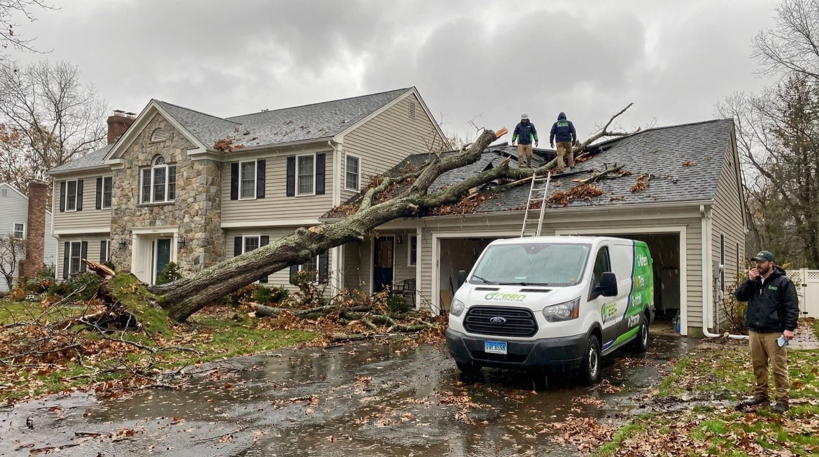
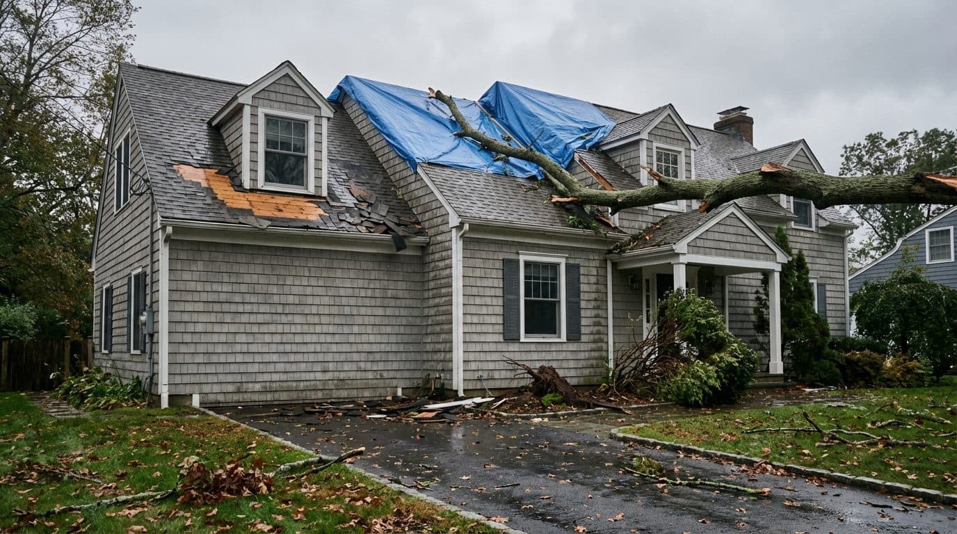
Emergency Roof Tarp-Up And Board-Up
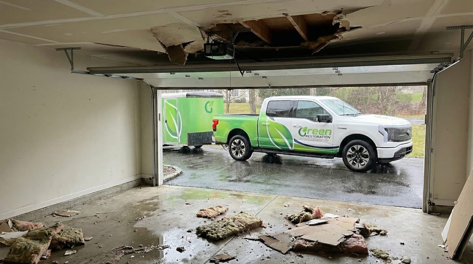
Same-day blue-tarp installation across wind-stripped roofs and fallen-tree impact zones on Barkhamsted properties, secured with furring strips and roofing nails, plus emergency board-up of broken windows and breached walls. Weather-tight protection for Pleasant Valley, Riverton, West Hill, and the West River Road corridor after nor'easters and summer storm events until permanent repairs begin.
Same-day tarp · Weather-tight seal
Fallen Tree And Wind Impact Response
Complete tree-impact response for the mature hardwood canopy across Barkhamsted's West Hill, Center Hill, and Washington Hill wooded ridgelines and the Farmington River valley: debris removal, structural assessment, emergency shoring of compromised pre-1900 timber framing, and coordination with licensed tree-removal crews. We stabilize the structure first, then move into water mitigation where the canopy breached the building envelope.
Structural shoring · Crew coordination
Additional Restoration Services
West Branch Farmington River AE Zone Overflow
The West Branch Farmington River, federally designated Wild and Scenic in 1994, runs roughly six miles through Barkhamsted carrying a FEMA Zone AE floodplain along West River Road and Pleasant Valley Road. Snowmelt from the Litchfield Hills and tropical-system rainfall push the West Branch over its banks into riverside cellars and the Pleasant Valley village core. We deploy submersible pumps, extract silt from pre-1900 fieldstone foundations, and document FEMA zone reference for NFIP carriers.
Saville Dam And Reservoir-Corridor Surge
The Barkhamsted Reservoir holds 36.8 billion gallons behind the Saville Dam on Route 318, and the compensating outflow reintroduces AE designation along the East Branch below the dam. During sustained rainfall and spring snowmelt, managed releases combined with storm runoff raise the downstream reach quickly. We document release and lake-level data for NFIP scope packets and provide full IICRC S500-formatted documentation.
Fieldstone Foundation And Timber Framing Response
Barkhamsted housing stock dates largely to the late 18th and early 19th century, with timber-frame farmhouses on mortarless fieldstone foundations where floodwater entering at the sill plate wicks through the rubble cavity into framing above. West Branch flood events deposit river silt and Category 3 contamination into these cavities faster than modern platform-framed housing. We use FLIR thermal imaging to map hidden saturation before opening walls, and dry with commercial LGR dehumidifiers calibrated to stone and plaster-on-lath assemblies.
Septic Backup And Saturation Cleanup
Most Barkhamsted parcels rely on private septic systems and leach fields that saturate and surcharge during sustained West Branch flooding and hill-runoff events, forcing Category 3 sewage into lower levels. Full PPE HEPA response, controlled demolition, EPA-registered antimicrobial per IICRC S520-2024, and ACAC laboratory clearance before any reconstruction begins.
NFIP Documentation And Insurance Coordination
Every Barkhamsted flood job receives a complete NFIP-formatted scope packet: timestamped photo logs, daily Tramex CME 5 moisture readings, FEMA Map Service Center zone reference for the West Branch AE Zone corridor, high-water-mark documentation, and an itemized estimate for direct adjuster submission within the 60-day Proof of Loss window. We capture the Wild and Scenic corridor reference for NFIP claim support along West River Road.
Structural Drying And Mold Prevention
Phoenix Axial commercial movers and LGR dehumidifiers positioned by psychrometric calculation for Barkhamsted's pre-1900 timber-frame farmhouses, Pleasant Valley mid-century ranches, and reservoir-corridor properties. Daily Tramex moisture readings logged until ANSI/IICRC S500-2021 dry standard confirmed at every monitoring point. The 48-hour mold colonization window is especially short in Barkhamsted's mortarless fieldstone cellars and plaster-on-lath cavities.
Don't Wait For Flood Damage To Get Worse. Every Minute Counts.
West Branch AE Zone, Reservoir Corridor, And Cat 3 Black Water Specialists For Barkhamsted.
Why The Water Category Decides Everything In A Barkhamsted Flood
Per IICRC S500-2021 §5.3, every flood loss is classified Category 1, 2, or 3 before scope is signed. Category drives demolition extent, antimicrobial protocol, drying timeline, and what your insurance carrier expects to see in the documentation. Most Barkhamsted flooding arrives as Category 2 to 3 depending on source. Hill-runoff stormwater is Category 2. West Branch overflow and rural septic backup are Category 3 on arrival per S500 §5.3.
Common Sources
Burst supply line, ice maker overflow, sink overflow
Restoration Protocol
Extract, dry, sanitize. Most porous materials salvageable if dried within 24 to 48 hours.
Drying typically 3 to 5 days
Common Sources
Washing machine discharge, dishwasher overflow, toilet overflow without solids, aquarium leak
Restoration Protocol
Extract, antimicrobial pre-treatment, dry, post-clean sanitize. Saturated carpet pad and porous insulation typically discarded.
Drying typically 4 to 7 days
Common Sources
Septic backup, West Branch Farmington River overflow, Saville Dam corridor surge, Still River confluence overflow, hill-runoff black water
Restoration Protocol
Full PPE response, controlled demolition of porous materials to sill plate, EPA-registered antimicrobial per IICRC S520-2024, post-treatment clearance sampling.
Restoration typically 7 to 14 days including reconstruction
Why this matters for Barkhamsted, CT
Wind-driven rain that enters through a roof breach can stay Category 1 if treated within hours.
The same water becomes Category 2 after 48 hours in a warm cavity, and Category 3 once it contacts standing sewage, soil, or decomposing organic material.
In a Barkhamsted flood loss, West Branch Farmington River overflow is Category 3 on arrival because river water carries watershed drainage and storm-runoff pollutants regardless of how clear it looks at the high-water mark on West River Road. Mortarless fieldstone cellars hold floodwater in the rubble cavity, so full-scope controlled demolition to the stone sill is required before drying scope is finalized in pre-1900 farmhouse stock.
Our Flood & Storm Damage Restoration Process In Barkhamsted, CT
From the first call to final walkthrough, every step is documented, insured, and owner-supervised.
Why Choose Us In Barkhamsted
Owner-led service with 60-minute response, direct insurance billing, and eco-friendly methods across Barkhamsted.
60-Minute Emergency Response
IICRC-certified crews arrive within 60 minutes, day or night, every day of the year.
Owner-Operated Local Crew
Every job is personally overseen by our owner, from first call to final moisture reading.
Direct Insurance Billing
We bill State Farm, Liberty Mutual, USAA, Travelers, Allstate, and Chubb directly under HIC.0668405.
EPA-Registered Antimicrobials
EPA-registered antimicrobials and Safer Choice cleaning products applied per IICRC S500 and S520 standards.
Barkhamsted Emergency Utility Lines
Stopping water at the source is step 1 of any water-damage scope. Use these verified Barkhamsted lines while our IICRC crew is en route.For life-threatening emergencies (active fire, gas odor, electrical shock), call 911 first.
Water Authority
Metropolitan District (MDC) Reservoir Operations
(860) 278-7850
Most Barkhamsted homes run private wells and septic. Call the MDC line for any concern near the Barkhamsted Reservoir or Saville Dam corridor.
Source: themdc.org
Gas Leak
Eversource Gas (Yankee Gas)
(877) 944-5325
If you smell gas, leave immediately, call 911 first, then this line from a safe location.
Source: eversource.com
Electric Emergency
Eversource Electric
(800) 286-2000
Submerged outlets or wet panel: cut breaker, then call to confirm service drop is safe.
Source: eversource.com
Police (Non-Emergency)
CT State Police Troop B / Barkhamsted Resident Trooper
(860) 626-7900
Barkhamsted is patrolled by the resident state trooper program. Sewer or septic Cat-3 claims sometimes need a report number.
Source: portal.ct.gov
Numbers verified against public utility and municipal sources. Green Restoration is not affiliated with these agencies. We provide these as a courtesy resource alongside our IICRC water-damage response.
FEMA Flood Zones In Barkhamsted, CT
Your FEMA zone decides whether your mortgage lender requires NFIP coverage, what premium tier you pay, and which Base Flood Elevation determines a covered loss. We document zone designation, BFE, and high-water mark on every Barkhamsted flood scope so adjusters from Wright National Flood, Allstate Flood, and Write-Your-Own carriers have what they need to approve the claim.
1% annual chance floodplain. NFIP required for federally-backed loans.
Affected In Barkhamsted
West Branch Farmington River corridor along West River Road and Pleasant Valley Road; Senior Center at 109 West River Road sits within the AE designation
NFIP required
Shallow ponding at 1 to 3 feet depth near low-lying drainage.
Affected In Barkhamsted
Low-lying parcels near the Still River confluence at Riverton and Lake McDonough outflow margins; verify parcel at FEMA Map Service Center
NFIP depth-rated
Sheet-flow flooding at 1 to 3 feet depth along stream corridors.
Affected In Barkhamsted
West Branch and East Branch lower drainage swales near Route 318 and Route 181 low crossings below the Saville Dam; verify parcel at FEMA Map Service Center
NFIP depth-rated
500-year floodplain or outside mapped 1%. Roughly 25% of NFIP claims still come from Zone X.
Affected In Barkhamsted
West Hill, Center Hill, Washington Hill, and Mallory upland ridge parcels above the river corridor
NFIP optional
Zone definitions sourced from FEMA Flood Map Service Center + 44 CFR Part 64. Verify your property zone before any policy renewal.
Where Flood Zones Hit Hardest In Barkhamsted
West Branch Farmington River 1% annual chance floodplain through the Pleasant Valley reach
West Branch and Still River exposure near the channel; surrounding parcels Shaded X
500-year floodplain; upland ridge hillside runoff risk above the river corridor
Compensating outflow below the 1940 Saville Dam reintroduces AE designation along the East Branch; managed dam releases combined with storm runoff raise the downstream reach quickly
Sourced from FEMA Map Service Center FIRM panels for Barkhamsted, CT. Verify your property zone before policy renewal.
The Anatomy Of A Flood Damage Restoration
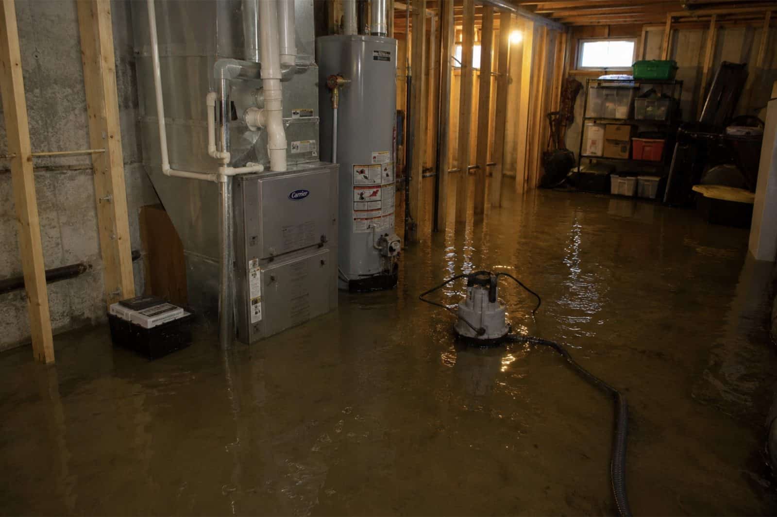
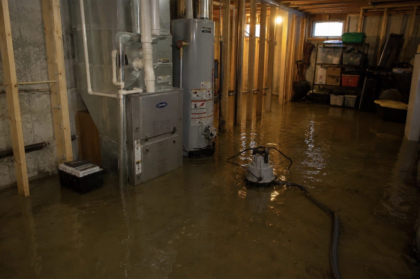
Every flood loss looks different, but the protocol does not. Below is what a typical Category 2 to 3 basement flood looks like once extraction starts and how Green Restoration sequences the scope. Photos are representative of common Litchfield County flood scenes and are not necessarily from a specific Barkhamsted property.
What A Category 3 Flood Loss Looks Like
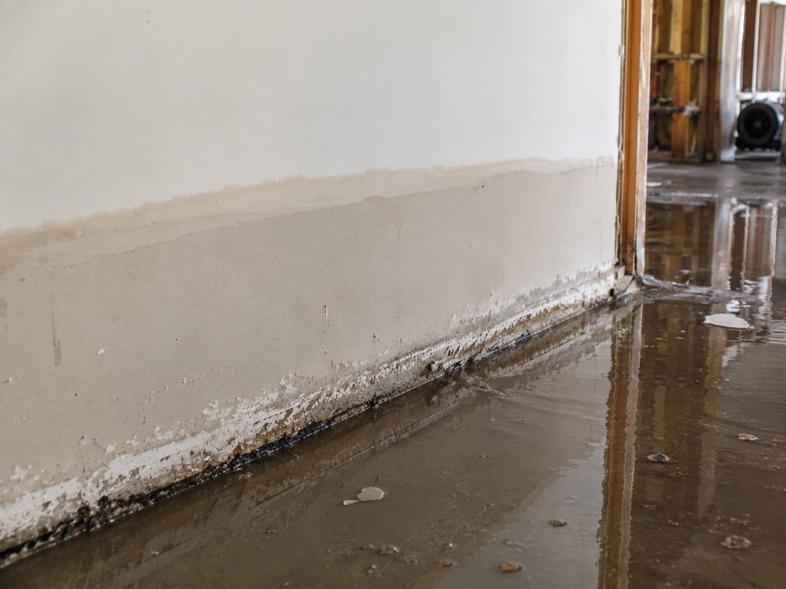
The horizontal line marks where standing water sat for hours. Drywall below the line is saturated, plaster behind it has wicked cavity moisture, and porous insulation has begun mold colonization within 24 to 48 hours.
Most Common Loss
Basement Cat 2 to 3
Sump pump failure during a storm outage, municipal sewer backflow during sustained rain, and river overflow into below-grade rooms are the flood losses we are called to most often across Litchfield County. Plaster, fieldstone, and slow-drying cavities trap moisture beyond surface readings.
Typical scope $3,500 to $12,000
NW Corner Variant
West Branch Flash Flood
West Branch Farmington River overflow along West River Road AE Zone during spring snowmelt and sustained Litchfield Hills rainfall. River water is Category 3 on arrival per IICRC S500 §5.3. The Wild and Scenic corridor and Saville Dam reach establish a documented flood-loss pattern useful for NFIP claim support.
Typical scope $8,000 to $50,000+
Typical Timeline
7 to 14 Days
Days 1-2: PPE extraction and porous demolition to sill plate. Days 2-4: EPA-registered antimicrobial per IICRC S520-2024. Days 4-8: Phoenix Axial structural drying with daily Tramex CME 5 verification to ANSI/IICRC dry standard. Days 8-14: ACAC clearance + reconstruction.
Daily moisture logs filed with carrier
Documentation
NFIP + Homeowners
Base flood elevation reference from FEMA Map Service Center, timestamped high-water-mark photographs from multiple angles, daily Tramex moisture readings, and a complete IICRC S500 scope packet formatted for both your Write-Your-Own NFIP carrier and your homeowners adjuster.
60-day NFIP Proof of Loss window
Recent Anonymized Barkhamsted Restorations
West River Road
West Branch Farmington River spring surge
- 13 in. in ground-floor pre-1900 fieldstone cellar
- 9 days to ANSI/IICRC dry
- NFIP + Travelers homeowners split file
Riverton
West Branch flash flooding + septic surcharge
- Lower-level mill-district masonry crawl and finished basement
- 10 days to S520 clearance
- Septic endorsement + homeowners claim
Pleasant Valley
Hill-runoff stormwater overflow into ranch basement
- 8 in. standing water
- 6 days to ASTM E1745 dry
- Homeowners carrier file
Snapshots are anonymized real Barkhamsted and Litchfield County jobs. The West Branch Farmington River AE Zone runs through the West River Road corridor. Scope ranges typical of Northwest CT inland river flood losses.
What To Do After Flooding In Barkhamsted, CT
West Branch Farmington River AE Zone overflow, Saville Dam corridor surge, and rural septic backup require different handling than a clean burst pipe. Follow these IICRC S500 §5.3 protocols while waiting for our crews.
What To Do Immediately
In sustained West Branch Farmington River overflow events, leave and do not return until Eversource and local emergency services confirm safe access.
NFIP and homeowners adjusters require timestamped images of the highest waterline. Capture from multiple angles before any cleanup begins.
If the breaker panel is dry and reachable without standing in water, shut off main power. If wet, call Eversource emergency first.
West Branch overflow and septic backup are Category 3 by IICRC S500 §5.3. Wear PPE, do not enter without N95 plus gloves.
Federal flood policies require a signed Proof of Loss within 60 days. We document the scope and provide the file.
Our IICRC-certified Litchfield County team arrives within 60 minutes with extractors and fieldstone-cellar drying protocol.
What NOT To Do
Submerged outlets and contaminated water create electrocution and infection risk.
Consumer wet-vacs cannot handle Category 3 volume or biohazard contamination.
Floodwater in ductwork spreads contaminants through fieldstone cellars and timber framing. Have the system inspected first.
NFIP adjusters require an inventory before contents leave the property.
Raw sewage carries pathogens. Stay out until professional containment is set up.
Mold colonization begins within 48 hours in mortarless fieldstone cellars and plaster cavities. Every additional day multiplies scope and claim cost.
The Flood-Control System Behind Barkhamsted
Barkhamsted flood exposure is shaped by the West Branch Farmington River, a federally designated Wild and Scenic River that runs through town, and the Barkhamsted Reservoir, impounded behind the Saville Dam on Route 318.
West Branch Farmington River AE Floodplain
FEMA Region 1 + Town of Barkhamsted
Federal Flood Insurance Rate Map Zone AE designation along the West Branch Farmington River through the West River Road and Pleasant Valley Road corridor. The Wild and Scenic corridor carries recurring spring-snowmelt and storm surge into riverside parcels including the Senior Center at 109 West River Road. NFIP coverage required for federally backed mortgages on parcels within the 1 percent annual chance floodplain.
Barkhamsted Reservoir And Saville Dam
Metropolitan District (MDC) + CT DEEP
The 36.8-billion-gallon Barkhamsted Reservoir is impounded behind the Saville Dam, a 135-foot earthen embankment on the East Branch Farmington River completed in 1940. Compensating outflow below the dam reintroduces AE designation along the East Branch, and managed releases combined with storm runoff raise the downstream reach quickly during sustained precipitation.
Northwest Corner Watershed Corridor
CT DEEP Stormwater Management
The Northwest Corner watershed above Barkhamsted channels hillside runoff from Colebrook, Hartland, and Norfolk into the Farmington River basin. Sustained precipitation across the upper watershed concentrates flow through the West Branch channel, raising flood risk for Barkhamsted AE Zone parcels faster than forecast models suggest based on local rainfall alone.
Still River Confluence At Riverton
CT DEEP Farmington River Watershed
The Still River meets the West Branch Farmington River at the Riverton village core, and the combined channel carries an AE floodplain edge that fades to Shaded X across surrounding parcels. During spring snowmelt and sustained Litchfield Hills rainfall, the two channels crest together and back water into the mill-era brick and wood-frame stock of the Riverton Historic District. Lake McDonough outflow and the Pleasant Valley reach add to the volume moving through the confluence below the Saville Dam compensating release.
Flood Damage Restoration Coverage In Barkhamsted, CT
West Branch overflow, Saville Dam corridor surge, and Category 3 septic backup cleanup for Barkhamsted homes and businesses. Northwest Corner inland flood specialists with 60-minute response from our local crews across all Barkhamsted villages.
Green Restoration provides IICRC S500-certified flood damage restoration in Barkhamsted, CT, with deep coverage across neighborhoods most exposed to West Branch Farmington River AE Zone overflow, Saville Dam corridor surge, Still River confluence drainage, and rural septic backup.
West River Road and Pleasant Valley Road sit in FEMA Zone AE along the West Branch Farmington River; West Hill, Center Hill, Washington Hill, and Mallory upland parcels carry Zone X hillside runoff risk.
With direct access via Route 44, Route 318, and Route 181 from our Litchfield County location, our IICRC-certified crews respond in 60 minutes, day or night.
As a locally owned company based at Serving Barkhamsted and the Farmington River corridor, CT, we know the specific challenges Barkhamsted properties face: Late 18th and early 19th century timber-frame farmhouses on mortarless fieldstone foundations across West Hill and Center Hill, Riverton Historic District mill-era brick and wood-frame stock, Pleasant Valley mid-century Cape Cod and ranch slabs, and reservoir-corridor cabin stock, and the IICRC S500 §5.3 Category 3 protocol every flood requires on arrival.
We submit IICRC-standard documentation directly to your insurer. We are not licensed public adjusters and do not negotiate claims on your behalf.
Flood Emergency In Barkhamsted?
Category 3 dispatch and NFIP documentation, 24/7/365.
(860) 222-9498IICRC Certified Firm · Licensed & Insured · CT CT HIC.0668405 · Licensed & Insured In CT · All Insurance Accepted
See typical Barkhamsted flood damage pricing in 60 seconds. Category 1 to 3.
All Towns Served By Green Restoration Of Litchfield County From Our Litchfield County Location For Emergency Flood Damage Restoration & NFIP Documentation.
Free On-Site Assessment
Not sure what you are dealing with in Barkhamsted?
We establish the scope on site, before anything is quoted.
(860) 222-9498How Barkhamsted West Branch Farmington River And Reservoir Geography Shapes A Flood Scope
Barkhamsted sits in a river valley where the West Branch Farmington River, federally designated Wild and Scenic in 1994, runs roughly six miles through town, creating a FEMA Zone AE floodplain corridor along West River Road and Pleasant Valley Road. Snowmelt from the Litchfield Hills and sustained rainfall push the West Branch over its banks into riverside cellars and the Pleasant Valley village core. The Barkhamsted Reservoir, impounded behind the Saville Dam on Route 318, holds 36.8 billion gallons, and its compensating outflow reintroduces AE designation along the East Branch below the dam.
The Northwest Corner watershed above Barkhamsted channels hillside runoff from Colebrook, Hartland, and Norfolk into the Farmington River basin. Barkhamsted housing stock spans late 18th and early 19th century timber-frame farmhouses on mortarless fieldstone across West Hill and Center Hill, Riverton Historic District mill-era brick, Pleasant Valley mid-century ranches, and reservoir-corridor cabin stock, each requiring calibrated drying protocol.
24/7 Flood & Storm Damage Response In Barkhamsted, CT
Our IICRC-certified Litchfield County flood crew dispatches to Barkhamsted Category 3 emergencies around the clock. Most West Branch overflow calls are on site within the hour with full PPE and fieldstone-cellar drying protocol.
Calls answered around the clock. Hydramaster trucks dispatch from our Litchfield County crews within the hour across Barkhamsted and all Farmington River corridor villages.
Full PPE extraction, mortarless fieldstone cellar drying at controlled rates, EPA-registered antimicrobial, and ACAC clearance before reconstruction.
We submit IICRC S500 documentation and NFIP-formatted scope packets directly to your carriers. We are not licensed public adjusters.
Every Barkhamsted flood project documented with timestamped logs, daily moisture readings, FEMA zone reference, and a complete scope packet filed within 60 days.
About Green Restoration In Barkhamsted, CT
Your Barkhamsted Flood & Storm Damage Specialists Since 2014
Green Restoration provides IICRC S500 §5.3 flood damage cleanup and structural drying for homes and businesses in Barkhamsted, CT. Our protocol includes specialty mortarless fieldstone cellar drying at controlled rates, Category 3 West Branch extraction, EPA-registered antimicrobial per S520-2024, and NFIP-formatted documentation for Barkhamsted homeowners.

“As the local Franchise Owner across Litchfield County, I bring 15 years in restoration and IICRC AMRT plus WRT certifications to every Barkhamsted flood scope. West Branch Farmington River AE Zone overflow into pre-1900 fieldstone cellars, Saville Dam corridor surge, and rural septic backup all require a different protocol than a clean burst pipe. Mortarless fieldstone holds floodwater in the rubble cavity long after the surface dries, so full-scope controlled demolition to the stone sill comes before any drying scope is finalized. Every Barkhamsted job gets my direct oversight, documented to S500 standard, billed to your carrier.”
How Much Does Flood Damage Restoration Cost In Barkhamsted, CT?
Pre-1900 fieldstone-foundation farmhouse scopes in Barkhamsted trend higher due to controlled rubble-cavity drying protocol and Wild and Scenic corridor documentation for pre-1900 structural elements.
River + Septic Backup
$8,000 to $50,000+
West Branch overflow, septic backup, Category 3 extraction from pre-1900 fieldstone cellars
Surface Flooding
$3,500 to $12,000
Hill-runoff stormwater, snowmelt, light silt in Pleasant Valley ranch slabs
Clean Rainwater
$1,500 to $4,500
Rainwater intrusion through wind-created opening
Barkhamsted Flood Damage Restoration FAQs
No. Connecticut homeowner policies explicitly exclude flood, surface water, and river overflow. West Branch Farmington River AE Zone overflow along West River Road and Pleasant Valley Road requires a separate NFIP flood policy. What homeowners policies cover: sudden and accidental supply-line bursts, appliance overflows, and wind-driven rain through a wind-created opening. Septic backup is excluded unless you carry a backup endorsement. We are not licensed public adjusters and do not negotiate claims on your behalf.
Yes. Parcels along the West Branch Farmington River through West River Road and Pleasant Valley Road sit inside FEMA Zone AE, the 1 percent annual chance floodplain of a federally designated Wild and Scenic River. The Senior Center corridor at 109 West River Road sits within the AE designation. Upland ridges including West Hill, Center Hill, Washington Hill, and Mallory fall in Zone X. Verify your specific parcel zone via FEMA Flood Maps at msc.fema.gov.
NFIP requires you to file a signed Proof of Loss within 60 days of the date of loss. Green Restoration provides timestamped photo logs, IICRC S500 moisture readings, FEMA Map Service Center zone reference, and a complete itemized scope for direct adjuster submission so Barkhamsted homeowners meet the deadline with a defensible file covering West Branch AE Zone events.
NFIP caps single-family residential coverage at 250,000 dollars building and 100,000 dollars contents. Building and contents carry separate deductibles from 1,000 to 10,000 dollars. NFIP has a 30-day waiting period. For Barkhamsted pre-1900 timber-frame farmhouses with original plaster-on-lath and mortarless fieldstone foundations, replacement-cost values for period materials may exceed NFIP caps, making flood endorsements important supplemental coverage.
Category 1 is clean supply-line water. Category 2 is Still River or hill-runoff stormwater overflow requiring antimicrobial treatment. Category 3 is black water including West Branch Farmington River overflow, reservoir-corridor surge, and septic backup. Category 3 requires full PPE response, controlled demolition to the stone sill, EPA-registered antimicrobial per IICRC S520-2024, and laboratory clearance. West Branch floodwater is Category 3 on arrival because it carries watershed drainage and storm-runoff pollutants.
Our response across Barkhamsted is 60 minutes or less, 24/7, including Pleasant Valley, Riverton, West Hill, Center Hill, and the West River Road corridor. Pleasant Valley and West River Road addresses typically see arrival inside 50 to 60 minutes. Upland ridge and reservoir-corridor parcels run 55 to 65 minutes. Our crews dispatch with Hydramaster CDS-4.8 extractors, submersible pumps, Phoenix Axial movers, LGR dehumidifiers, full PPE, and EPA-registered antimicrobials. Call (860) 222-9498 any time.
When the President declares a federal disaster, FEMA Individual Assistance can pay up to 43,600 dollars in Housing Assistance plus 43,600 dollars in Other Needs Assistance. SBA disaster loans run alongside: up to 500,000 dollars for primary residence repairs. A West Branch Farmington River flood that reaches Barkhamsted riverside parcels can qualify for documented flood-loss support useful for NFIP claims.
Category 2 hill-runoff stormwater overflow into a Pleasant Valley mid-century ranch typically runs 3,500 to 12,000 dollars. Category 3 West Branch overflow into a pre-1900 fieldstone-foundation farmhouse with original plaster-on-lath runs 8,000 to 50,000 dollars plus, driven by porous material demolition to the stone sill and fieldstone cavity drying. We provide a written estimate on-site after Tramex CME 5 readings confirm the full scope.
Yes. Spring snowmelt from the Litchfield Hills raises West Branch Farmington River discharge rapidly through the Northwest Corner watershed, and managed releases from the Saville Dam add to the downstream reach. Ice-jam releases can push West Branch AE Zone parcels above flood stage with minimal warning. We carry submersible pumps for cold-water extraction, LGR dehumidifiers calibrated for saturated fieldstone cellars, and run daily Tramex readings until dry standard is confirmed. Call (860) 222-9498 for 24/7 Litchfield County dispatch.
If West Branch Farmington River water is rising rapidly, evacuate and do not return until Eversource and local emergency services confirm safe access. Photograph high-water marks from multiple angles before cleanup. Shut off power at the main only if the panel is dry. Treat all floodwater as Category 3. Do not run HVAC because improper airflow spreads contaminants through fieldstone cellars and timber framing. Call (860) 222-9498 for IICRC-certified dispatch.
Green Restoration is an IICRC-certified firm led by our owner, IICRC AMRT and WRT certified, with 15 years serving Litchfield County. Our trucks carry Hydramaster extractors, submersible pumps, LGR dehumidifiers, FLIR thermal imaging, and EPA-registered antimicrobials. We specialize in mortarless fieldstone cellar drying for pre-1900 farmhouses with plaster-on-lath requiring controlled rates. Direct insurance billing, 60-minute response, HIC.0668405, Licensed and Insured In CT.
Usually yes. Connecticut homeowner policies generally cover wind, hail, and fallen-tree damage including interior water intrusion through a wind-created opening. They exclude rising surface water and West Branch overflow. After a nor'easter, a single Barkhamsted loss often involves both wind damage on the homeowners policy and river overflow or septic backup on the NFIP or backup endorsement. We document each cause separately. We are not licensed public adjusters.

