Flood & Storm Damage Restoration Mystic, CT
Tidal Backflow, River Flooding And Category 3 Storm Water 60-Minute Emergency Response, Direct Insurance Billing
 IICRC Certified
 Eco-Friendly Solutions For Healthier Spaces
Reviewed by David Megeneishvili·Licensed & Insured In CT·IICRC AMRT + WRT
What Is IICRC S500 §5.3 Flood Damage Restoration?
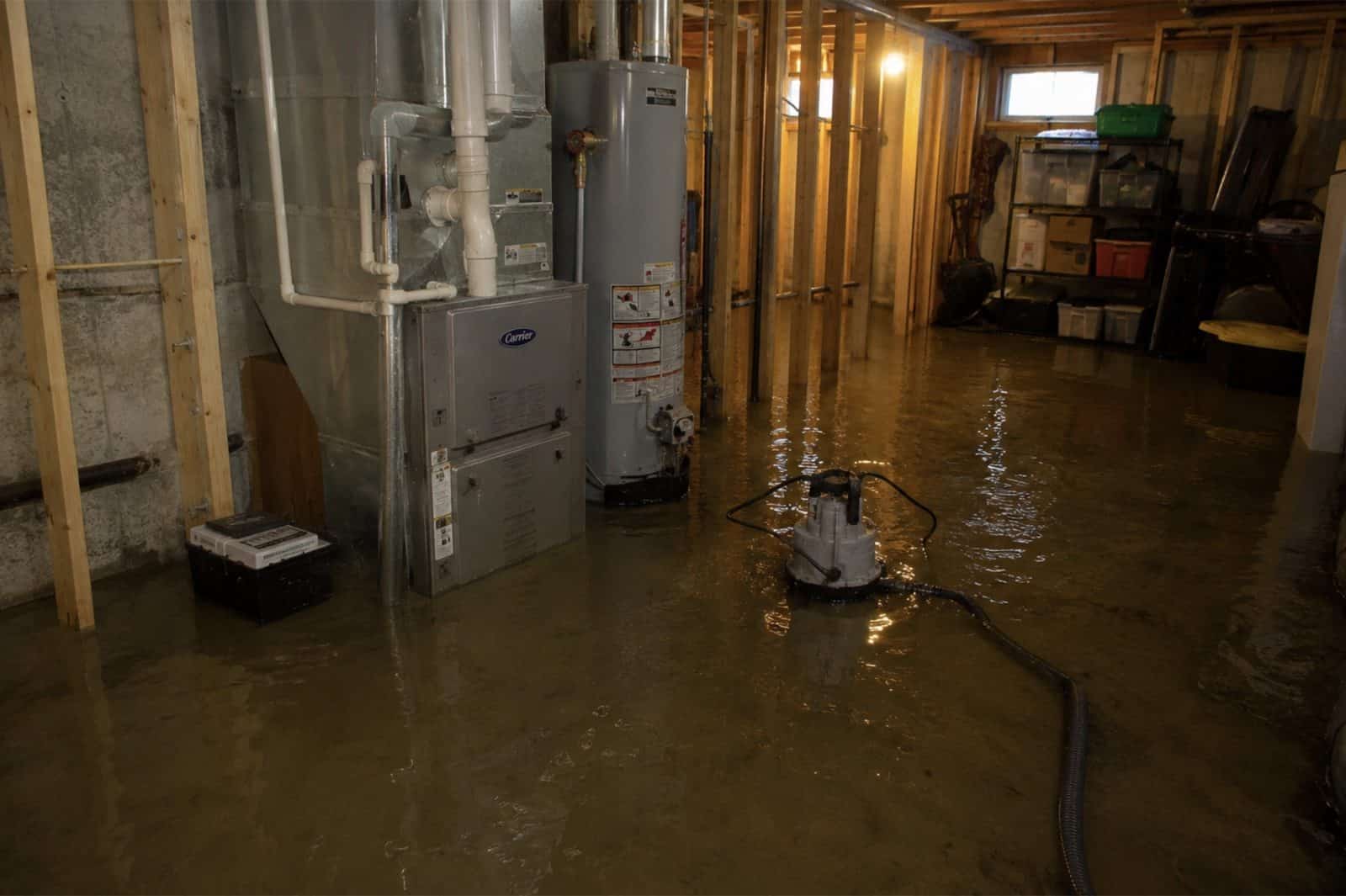
Flood damage restoration is the IICRC S500-2021 §5.3 documented process for Category 3 black water: full PPE response, controlled demolition of porous materials to sill plate, EPA-registered antimicrobial application per IICRC S520-2024, structural drying to ANSI/IICRC dry standard, and lab-verified post-remediation clearance before reconstruction. Mystic River and harbor water, brook water and anything that rises back through a drain whose outfall sits below the high tide line all arrive as Category 3 on contact, however clear the water looks against a wall.
In Mystic, CT, Green Restoration sequences every flood scope: 60-minute dispatch, FLIR thermal mapping and Tramex CME 5 moisture verification, truck-mounted Hydramaster extraction, controlled porous demolition, antimicrobial treatment, Phoenix Axial drying monitored daily, and a carrier-ready scope file with NFIP-formatted documentation, base flood elevation reference, and high-water-mark photographs filed within the 60 days NFIP Proof of Loss window.
- IICRC S500-2021 §5.3 aligned
- IICRC S520-2024 antimicrobial protocol
- ASTM E1745 Class I vapor retarder
- ASHRAE 160 humidity targets
- NFIP-formatted scope packet
- FEMA Map Service Center referenced
The Four Layers Of Flood Coverage In Mystic
NFIP Building
$250,000
single-family cap
NFIP Contents
$100,000
residential cap
FEMA IA Grant
$43,600
+ $43,600 ONA
SBA Home Loan
$500,000
from 2.875%
Your standard CT homeowners policy excludes flood, surface water, tidal overflow, and wave action. NFIP closes the gap with a 30 days waiting period and a 60 days Proof of Loss deadline. Add $30,000 Increased Cost of Compliance for elevation requirements.
Connecticut average NFIP claim payout was $8,727 in 2025 and the average policy premium runs $1,426/year for roughly $272,799 of coverage (per FEMA NFIP and CT Insurance Department data). This information is general education only, not insurance, legal, or coverage advice. We submit IICRC documentation directly to your insurer. We are not licensed public adjusters and do not negotiate, adjust, interpret your policy, or settle claims on your behalf.
How to clean up after a flood: our step by step first 48 hours guideConditions from the National Weather Service and Open-Meteo.
Trusted by Families in Mystic &
New London County
4.9 out of 5, Rated by your neighbors on Google
We discovered mold when removing our pellet stove and called Green Restoration for help. David was very communicative and helpful throughout the entire process. He did the job thoroughly and professionally. Highly recommended!
David Woolner
Mold RemediationI had a fantastic experience with Green Restoration. From start to finish, the team was professional, thorough, and extremely knowledgeable. David came for the initial inspection and took the time to explain the entire process.
Annmarie Gieparda
Mold RemediationWe had mold due to a water leak in our half finished basement. David and his crew did a great job, we were very satisfied. I would highly recommend Green Restoration to anyone.
Tanya
Water DamageI needed my entire condo completely cleaned after a soot blow back. Green Restoration was top shelf! So thorough and professional. Thank you so much!
Jacki Hornish
Fire & Soot CleanupMore Green Restoration Services in Mystic
The same local Green Restoration team covers all of these across Mystic. One number for every emergency and every cleanup.
What Does Flood & Storm Damage Restoration In Mystic, CT Involve?
Flood and storm damage restoration in Mystic, CT means extracting floodwater, drying the structure and repairing storm damage under IICRC S500-2021 section 5.3, the standard that classifies contaminated water and sets how it is remediated. Mystic is a village split between Groton and Stonington by the Mystic River, and the work here covers two emergencies handled by one crew: storm stabilization (emergency tarp-up, wind and fallen-tree impact, board-up) and Category 3 water (Mystic River and Mystic Harbor tidal flooding, coastal surge off Fishers Island Sound, brook flooding from the upper watershed, and sea water backing up through drain outfalls that sit below the high tide line).
Green Restoration extracts, applies EPA-registered antimicrobial per IICRC S520-2024, dries to the ANSI and IICRC standard, and files the loss against the correct NFIP community for your bank of the river. Response across Mystic is 60 minutes, 24/7.
Mystic Flood History
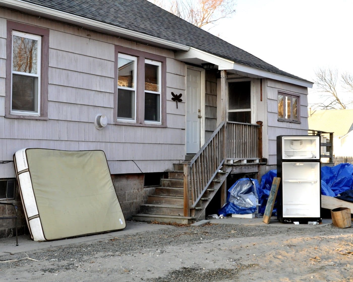
The Town of Stonington adopted hazard plan states that nearly the entire area of Mystic is located within the 1 percent annual chance floodplain, and that many drainage system outlets in Mystic are located below the high tide line, so during high tides sea water backs up into the drainage system and can cause flooding of Washington Street and Holmes Street. A king tide on a sunny day, October 28, 2015, inundated many sections of road on both the Groton side and the Stonington side of the village, peaking at 4.427 feet above mean lower low water at the New London gauge, roughly 1.4 feet above ordinary higher high water.
As of June 2022 the Town of Stonington recorded 13 repetitive loss properties and the Town of Groton eight, and the Stonington list names four of them Mystic River number one, Mystic River number two, Mystic Harbor number one and Mystic Harbor number two.
Source: Town of Stonington Annex and Town of Groton Annex to the SCCOG Multi-Jurisdictional Hazard Mitigation and Climate Adaptation Plan Update, both adopted 2023; NOAA CO-OPS station 8461490, New London; FEMA OpenFEMA NFIP Community Status Book. Photo: FEMA / DHS, public domain (representative regional photo).
- FEMA Designation
- VE and AE; the Town of Stonington states nearly the entire area of Mystic is inside the 1 percent annual chance floodplain
- Primary Flood Vectors
- Mystic River and Mystic Harbor tidal flooding, coastal surge off Fishers Island Sound, sea water backing up through drain outfalls below the high tide line, brook flooding from Whitford and Pequotsepos Brooks, wind and fallen-tree damage
- NFIP Coverage Caps
- $250K building · $100K contents
- Response
- 60 min, 24/7
Verify Your Flood Zone
(833) 833-3637Complete Flood & Storm Damage Restoration In Mystic, CT
One crew for both emergencies: storm stabilization, tarp-up and fallen-tree work, plus flood extraction for Mystic River and harbor water, coastal surge, brook flooding and tidal backup through the drains. Every loss documented against the correct NFIP community for your side of the river.
Category 3 Floodwater Extraction On Both Banks
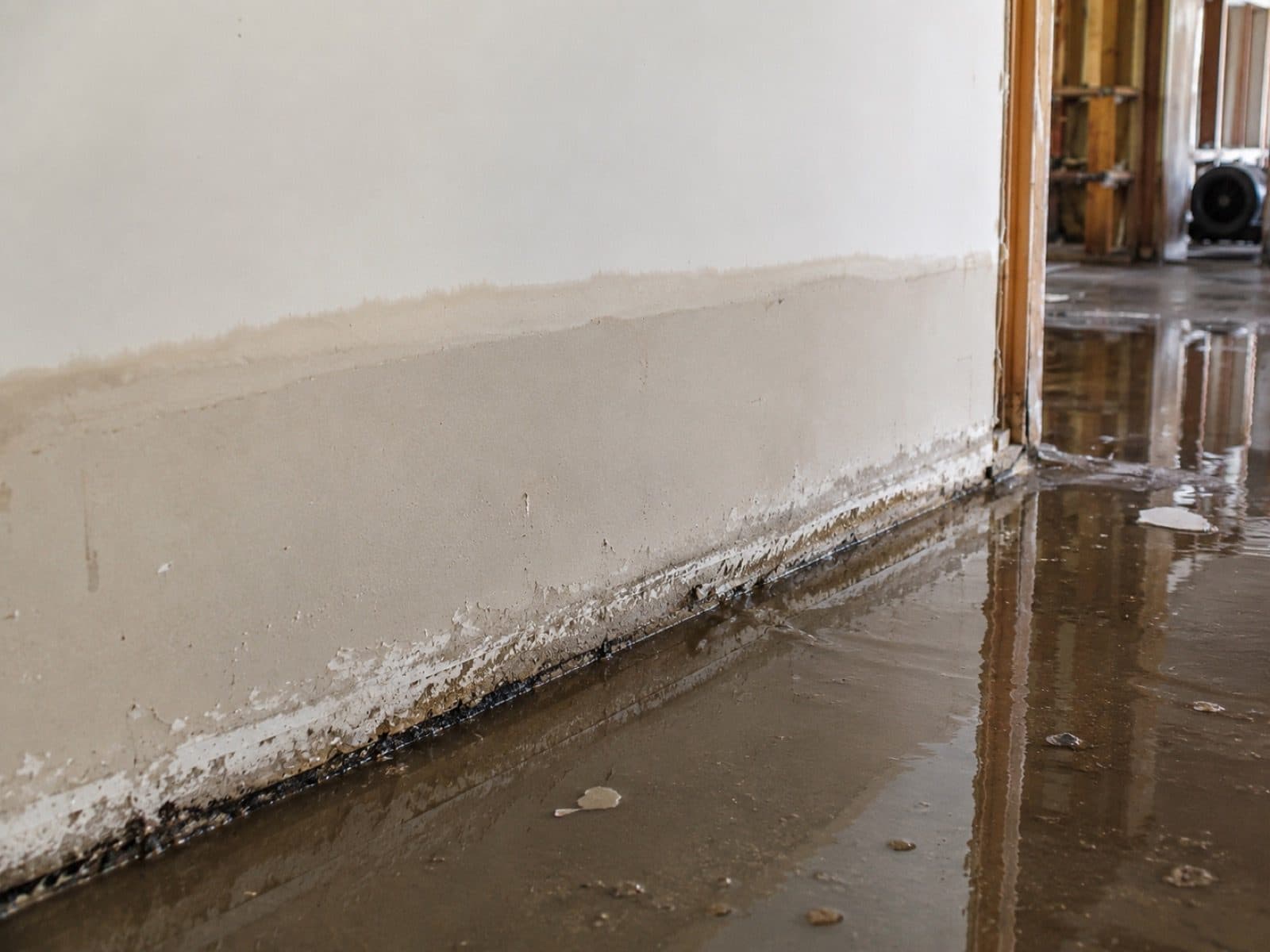
The Town of Stonington states in its own adopted hazard plan that nearly the entire area of Mystic sits inside the 1 percent annual chance floodplain. Water that has been in the Mystic River, in Mystic Harbor, or across a village street arrives carrying roadway runoff, soil bacteria and storm sewer content, which puts it in Category 3 under IICRC S500-2021 section 5.3 whatever it looks like against a wall. Full PPE crews extract with truck-mounted Hydramaster CDS-4.8 units and solids-rated submersible pumps, then set HEPA negative-air containment before any porous material is opened, on the Groton side and the Stonington side alike.
IICRC S500 §5.3 · Tramex CME 5 verified
Tidal Backflow Through Drains That Outlet Below High Tide
This is the mechanical fact that separates Mystic from an inland flood town. The Town of Stonington records that many drainage system outlets in Mystic sit below the high tide line, so at high tide sea water backs up into the drainage system and can flood Washington Street and Holmes Street. The water arrives upward, through the drain, with no rain falling. We treat the floor drain as a source rather than an outlet, cap and monitor it during extraction, and record the tide stage in the file because that single detail decides how a carrier reads the loss.
Drain treated as source · Tide stage logged
Sunny-Day King Tide And Nuisance Flooding Response
On October 28, 2015 a king tide on a clear day put water across many sections of road on the Groton side of Mystic, and the Town of Stonington records the same event inundating roads on its side of the river. That tide peaked at 4.427 feet above mean lower low water at the New London gauge, only about 1.4 feet above ordinary higher high water. Stonington also reports that complaints about nuisance high tide flooding in Mystic have increased in recent years. We respond to these calls the same way we respond to a storm, because the water is the same water and the drying clock starts at the same moment.
4.427 ft MLLW · Both sides of the river
Additional Restoration Services
Downtown Mystic Storm Surge Recovery
The Town of Stonington records that a Category One hurricane is enough to put storm surge across significant portions of downtown Mystic. The New London gauge, the reference station for this stretch of Fishers Island Sound, reached 8.879 feet above mean lower low water during Hurricane Carol on August 31, 1954 and 7.934 feet during Superstorm Sandy on October 29, 2012. Both hazard plans record the December 23, 2022 coastal flood as the sixth highest water surface elevation on record at that gauge, with numerous roads and structures flooded in coastal southeastern Connecticut including Mystic. We flush chloride salts, document deposition for the carrier, and dry with axial movers per S500 section 13.
Cloudburst And Brook Flooding From The Upper Watershed
Rain alone does it here too. A severe thunderstorm on July 1, 2009 dropped up to 6.5 inches in four hours and local fire departments pumped water out of more than 100 basements across Mystic, Groton, Stonington and Ledyard, with 50 to 60 cars inundated and trapped in the Mystic Aquarium parking lot and a portion of Route 1 in Mystic closed. The northeaster of March 29 and 30, 2010 delivered 8.6 inches, and the Town of Stonington records raging waters from Whitford Brook entering the Mystic River, homes with three feet of basement flooding, and Route 27 closed at the Groton and Stonington boundary with water rescues performed by the Old Mystic Fire Department.
Emergency Roof Tarp-Up And Board-Up
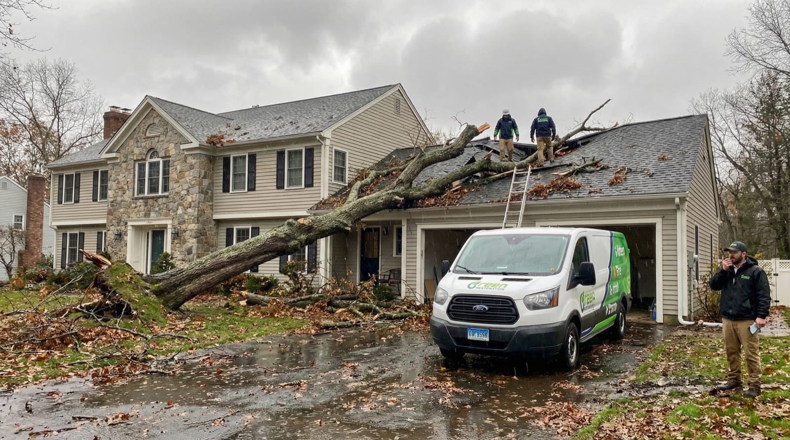
Same-day weather-tight tarp installation over wind-stripped and tree-impacted roof sections, secured with furring strips and roofing nails, plus board-up of broken windows and breached walls and shoring of compromised framing. Mystic has taken worse than wind-driven rain: the regional hazard plan records a tornado on September 18, 1918 that cut a path 130 to 160 feet wide from Groton through Mystic and out into Long Island Sound, damaging small buildings, roofs, trees and telephone poles. Photographing the damage before the tarp goes on is what protects the homeowners side of the claim.
Fallen Tree, Wind And Extended Outage Response
Tropical Storm Isaias on August 2, 2020 produced the highest number of outage events Connecticut has ever experienced, with more than 620,000 outages reported by Eversource alone, and the Town of Groton records that the wind damage exceeded expectations while the rainfall did not. Isaias is a wind and power story on this coast rather than a flood one, and that is exactly the loss we are staffed for: debris removal, structural assessment, emergency shoring, coordination with licensed tree-removal crews, and generator-powered drying so the clock does not stop when the block goes dark.
Sewer Backup And Wastewater Cleanup
Mystic is one of the few places east of the Thames River with its own municipal sewage treatment, and the Mystic Water Pollution Control Facility on Edgemont Street sits inside the 1 percent annual chance floodplain and a hurricane surge zone. The Town of Stonington notes that the facility elevated its generator during renovation but that complete NFIP adherence was not required and some variances were granted, and that many of the 17 sewer pumping stations in the town also sit in the floodplain or a surge zone. When that system loses head, what reaches a floor drain is Category 3 on contact. We handle it with EPA-registered antimicrobial per S520-2024, porous removal to the sill plate, and independent laboratory clearance.
Power Outage And Sump Pump Failure Response
A dead sump during an outage is one of the most ordinary ways a Mystic lower level fills, and the utility picture here changes at the river: a municipal utility serves the Groton side and Eversource serves the Stonington side, so the restoration timeline on one bank is not always the timeline on the other. We do not guess which provider serves your address. Every storm truck carries battery and gas-driven portable pumps for extraction without grid power, and we coordinate with electrical contractors on backup generator installation once the structure is dry.
Ground-Floor And Finished Basement Flood Restoration
The Town of Stonington records that businesses in the Mystic floodplain include many shops, restaurants, marinas and hotels in the downtown area, with residences on side streets and on ground set slightly away from downtown. Water Street appears in the Stonington Zone VE road table, and on the Groton side the adopted plan names Water Street, Cedar Road and the roads around Spencer Point and Willow Point as inside the Mystic River flood zone. Commercial ground floors and residential lower levels get the same sequence: extraction, controlled demolition to the sill plate, antimicrobial, and daily Tramex CME 5 readings until the assembly meets the ANSI and IICRC dry standard.
NFIP Documentation Across Two Different Flood Maps
One village, two NFIP communities, two effective maps. The Town of Groton, community 090097, has a currently effective flood map dated August 5, 2013. The Town of Stonington, community 090106, has one dated April 3, 2020. Stonington is a Community Rating System Class 7 community carrying a 15 percent flood insurance discount inside the special flood hazard area and 5 percent outside it, and the Town of Groton holds no CRS class at all. Same river, same storm, two different insurance positions. We pull the correct community and parcel designation from the FEMA Map Service Center at the start, photograph high-water marks, and file inside the 60-day NFIP Proof of Loss window.
Historic Structure Drying Near Or Over The Water
Mystic carries two National Register historic districts, one on each bank, listed a week apart in August 1979: the Mystic River Historic District in Groton and the Mystic Bridge Historic District in Stonington. The Town of Groton counts 223 at-risk historic assets inside its 1 percent annual chance flood zone, 57 of them in the coastal VE zone, and has a pilot study underway in Mystic on how a small number of historic structures may be mitigated without loss of historicity given that they sit near or over the water. We dry plaster, lath and old framing on their own monitoring points rather than a room average, because those assemblies release water slowly and split when the drying is pushed.
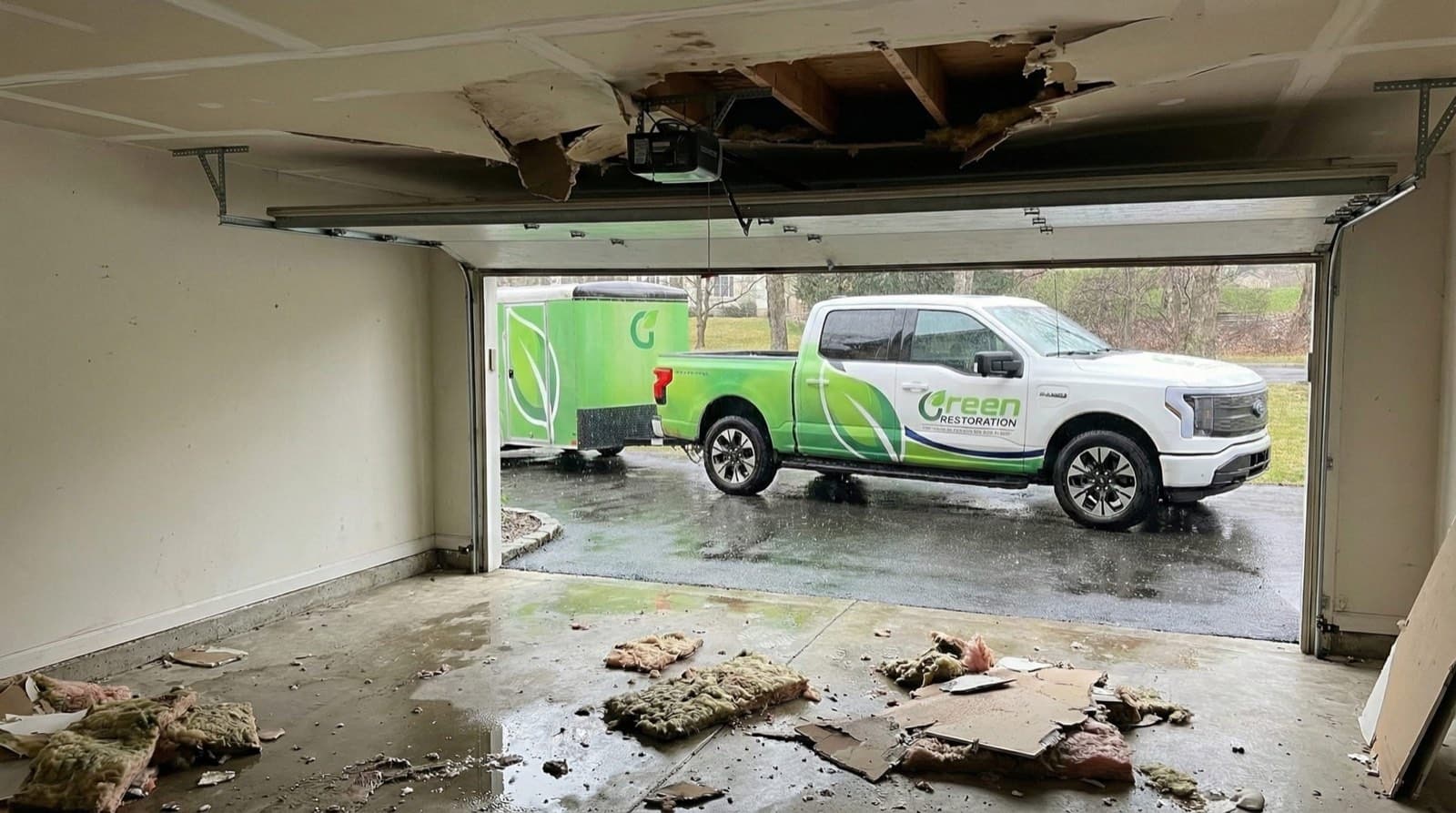
Do Not Let Flood Damage Set Into The Structure. Every Minute Counts.
Tidal Backflow, Coastal Surge And Category 3 Black Water Specialists On Both Banks Of The Mystic River.
Why The Water Category Decides Everything In A Mystic Flood
Per IICRC S500-2021 §5.3, every flood loss is classified Category 1, 2, or 3 before scope is signed. Category drives demolition extent, antimicrobial protocol, drying timeline, and what your insurance carrier expects to see in the documentation. Flooding in Mystic is Category 3 from the first minute in most cases, whether it came over a bank of the Mystic River, off the harbor on a high tide, out of Whitford Brook after a cloudburst, or upward through a floor drain whose outfall sits below the tide line.
Common Sources
Burst supply line, ice maker overflow, sink overflow
Restoration Protocol
Extract, dry, sanitize. Most porous materials salvageable if dried within 24 to 48 hours.
Drying typically 3 to 5 days
Common Sources
Washing machine discharge, dishwasher overflow, toilet overflow without solids, aquarium leak
Restoration Protocol
Extract, antimicrobial pre-treatment, dry, post-clean sanitize. Saturated carpet pad and porous insulation typically discarded.
Drying typically 4 to 7 days
Common Sources
Mystic River and Mystic Harbor water, coastal surge off Fishers Island Sound, sea water rising back through drain outfalls below the high tide line, brook flooding, standing street water, sewer backup with solids
Restoration Protocol
Full PPE response, controlled demolition of porous materials to sill plate, EPA-registered antimicrobial per IICRC S520-2024, post-treatment clearance sampling.
Restoration typically 7 to 14 days including reconstruction
Why this matters for Mystic, CT
Wind-driven rain that enters through a roof breach can stay Category 1 if treated within hours.
The same water becomes Category 2 after 48 hours in a warm cavity, and Category 3 once it contacts standing sewage, soil, or decomposing organic material.
The mechanism that makes Mystic unusual is also what makes the water dirty. The Town of Stonington records that many drainage system outlets in the village sit below the high tide line, so at high tide the storm drainage runs backward and delivers harbor water into the street and the building. That water carries roadway runoff, soil bacteria and storm sewer content before it ever reaches a floor, and river water and brook water arrive with the same load. All of it is Category 3 under S500 section 5.3 however clear it looks against a wall.
According to Green Restoration, treating a tidal drain backup in Mystic as a clean-water event is the single decision that turns a week of drying into a demolition scope a month later.
Our Flood & Storm Damage Restoration Process In Mystic, CT
From the first call to final walkthrough, every step is documented, insured, and owner-supervised.
How would you like
to start?
Common range across Category 1 clean rainwater intrusion through Category 3 river, harbor and tidal drain water with porous demolition to the sill plate. A property inside one of the two Mystic historic districts or in a VE zone can carry construction constraints during reconstruction that sit outside the mitigation number. Final pricing follows the on-site Tramex inspection.
Get A Price Range In 60 Seconds.
Four quick IICRC S500-aligned questions. Starting figures published on this page. No call required, no email collected before you see the range.
Walk The Loss With The Owner.
Tramex CME 5 mapping plus a FLIR scan of the lower level and the framing above it, and a FEMA Map Service Center check on whether the parcel is VE, AE or X under the Groton or the Stonington map. Free, no obligation, owner-led on every Mystic flood job.
Ranges shown are starting figures only. Final pricing depends on on-site inspection, NFIP zone reference, and carrier coverage. We are not licensed public adjusters.
Why Choose Us In Mystic
Owner-led service with 60-minute response, direct insurance billing, and eco-friendly methods across Mystic.
60-Minute Emergency Response
IICRC-certified crews arrive within 60 minutes, day or night, every day of the year.
Owner-Operated Local Crew
Every job is personally overseen by our owner, from first call to final moisture reading.
Direct Insurance Billing
We bill State Farm, Liberty Mutual, USAA, Travelers, Allstate, and Chubb directly under HIC.0668405.
EPA-Registered Antimicrobials
EPA-registered antimicrobials and Safer Choice cleaning products applied per IICRC S500 and S520 standards.
Mystic Emergency Utility Lines
Stopping water at the source is step 1 of any water-damage scope. Use these verified Mystic lines while our IICRC crew is en route.For life-threatening emergencies (active fire, gas odor, electrical shock), call 911 first.
Water Authority
Aquarion Water (Mystic Service Area)
(800) 732-9678
24/7 emergency. Aquarion serves the Mystic village service area. Request curb-stop shutoff if your main valve fails.
Source: aquarionwater.com
Gas Leak
Eversource Gas (Yankee Gas)
(877) 944-5325
If you smell gas, leave immediately, call 911 first, then this line from a safe location.
Source: eversource.com
Electric Emergency
Eversource Electric
(800) 286-2000
Submerged outlets or wet panel: cut breaker, then call to confirm service drop is safe.
Source: eversource.com
Police (Non-Emergency)
Stonington Police (Mystic-East side) / Groton Town Police (Mystic-West side)
(860) 599-4411
Sewer-backup Cat-3 claims sometimes need a police report. Mystic spans Groton and Stonington jurisdictions.
Source: stonington-ct.gov
Numbers verified against public utility and municipal sources. Green Restoration is not affiliated with these agencies. We provide these as a courtesy resource alongside our IICRC water-damage response.
FEMA Flood Zones In Mystic, CT
Your FEMA zone decides whether your mortgage lender requires NFIP coverage, what premium tier you pay, and which Base Flood Elevation determines a covered loss. We document zone designation, BFE, and high-water mark on every Mystic flood scope so adjusters from Wright National Flood, Allstate Flood, and Write-Your-Own carriers have what they need to approve the claim.
Coastal high hazard area where wave action is expected on top of the base flood. The strictest coastal designation, with construction and elevation requirements to match.
Affected In Mystic
Water Street, North Water Street, Riverside Drive and Masons Island Road appear in the Stonington Zone VE road table; Groton counts 541 coastal VE parcels town-wide valued at 582,855,150 dollars
NFIP required, construction restricted
1% annual chance floodplain carrying a published base flood elevation. This is the designation across most of low-lying downtown Mystic.
Affected In Mystic
Downtown Mystic on both banks, where Stonington states nearly the entire area sits inside the 1 percent annual chance floodplain; Groton counts roughly 925 structures town-wide in the AE zone
NFIP required
1% annual chance floodplain with no published base flood elevation, the usual case on smaller watercourses.
Affected In Mystic
Reaches of Whitford Brook, Pequotsepos Brook, Copps Brook and the Haleys Brook and Blindloss Brook drainage that flows east toward the Mystic River
NFIP required
0.2% annual chance flood hazard area or ground outside the mapped 1% zone. Roughly 25% of NFIP claims still originate in lower-risk zones.
Affected In Mystic
Higher ground back from the river on both banks; Groton records 2,907 parcels town-wide in the 0.2 percent exposure valued at 2,189,466,300 dollars
NFIP optional
Zone definitions sourced from FEMA Flood Map Service Center + 44 CFR Part 64. Verify your property zone before any policy renewal.
Where Flood Zones Hit Hardest In Mystic
Stonington states nearly the entire area of Mystic is inside the 1 percent annual chance floodplain, and that a system of dikes and pumping stations may be the only long-term solution for the lowest, most densely developed downtown ground
Named by the Town of Stonington for flooding caused by sea water backing up through drainage outlets that sit below the high tide line; a resilient seawall along Holmes Street is in design
The Town of Groton names Water Street, Cedar Road and the roads around Spencer Point and Willow Point in the Mystic River flood zone, and flags Willow Point for the potential to be isolated during flooding
Stonington records that portions of Route 27 can flood and isolate neighborhoods in the Clipper Drive area, and Route 27 was closed at the Groton and Stonington boundary during the March 2010 flood
Sourced from FEMA Map Service Center FIRM panels for Mystic, CT. Verify your property zone before policy renewal.
What To Do After Flooding In Mystic, CT
In Mystic the water can arrive four ways on the same bad night: over a bank of the Mystic River, off the harbor on a high tide, out of a brook after a cloudburst, and upward through a floor drain whose outfall sits under the tide line. Here is what the first hour looks like, and what to leave alone.
What To Do Immediately
In Mystic the lowest room usually holds the panel, the mechanicals and the stock. Move people up, and let the electric provider clear the building before anyone goes back down for anything. A municipal utility serves the Groton side and Eversource serves the Stonington side, so confirm which one is yours before you call.
The adjuster values what the first frames show. Capture the highest line on every wall, the mechanicals, anything stored at floor level and the floor drain itself, all timestamped, because in Mystic that drain is frequently the source rather than the outlet.
Write down when the water started and where the tide was. In a village whose drain outfalls sit below the high tide line, that single note separates a tidal event from a rainfall event, and the two are handled and covered differently.
Cut the main if you can reach a dry panel without standing in water. In the older Mystic stock on Water Street, Holmes Street and Cottrell Street the panel is often in the wet room, and when there is any doubt the call goes to the utility rather than into the water.
Mystic River and Mystic Harbor water, brook water and anything that came back up a drain all carry runoff and storm sewer content. It is Category 3 under IICRC S500 section 5.3 on contact. N95, gloves and eye protection, or stay out of the space.
Mystic crews respond in 60 minutes with truck-mounted extraction, solids-rated pumps, PPE and generator power already loaded, and we plan the approach around the bascule bridge and around whichever Route 27 sections are under water.
What NOT To Do
A submerged outlet and a live panel turn standing water into a hazard you cannot see through. Nothing stored in a Mystic lower level justifies entering before shutoff is confirmed.
A shop vac moves a few gallons and spreads contamination the whole time. River, harbor and tidal drain water needs solids-rated pumping and truck-mounted extraction, and every remaining surface still needs antimicrobial treatment afterward.
If the water came up through a drain, it is tied to the tide rather than the sky, and it can keep arriving under a clear sky. Plugging or monitoring the drain matters more than waiting out the weather.
In a Mystic lower level the boiler or furnace is the first thing underwater. Firing it back up drives whatever the water carried through the whole building. It stays off until it has been inspected.
Mystic has two National Register historic districts, one on each bank. Plaster, lath and original trim carry constraints on what may be replaced, so it gets photographed, metered and scoped before anything is pulled.
Colonization starts inside 24 to 48 hours and old coastal framing hides it well. Your policy already obliges you to prevent further damage, so waiting on a callback grows the loss and weakens your position on coverage.
The Flood-Control System Behind Mystic
Mystic is one of the more heavily studied pieces of coastline in Connecticut, and almost none of that study has turned into built protection yet. Both towns have adopted plans, both have named the streets, and the seawall and the elevations are still in design. Each item below belongs in the file, because it describes what is protecting a property today rather than what may protect it later.
The Downtown Mystic Resiliency And Sustainability Plan
Town of Groton
A resilience study for the Groton side of the village covering coastal flooding, sea level rise, stormwater flooding and rising temperatures. The town held a final public workshop on Pearl Street in Mystic on January 4, 2024, and its adopted mitigation action list carries an item to secure funding above one million dollars to advance at least one recommendation from the study, running to June 2026 through the DEEP Climate Resilience Fund and CIRCA Resilient Connecticut.
Two related Groton actions are underway: a pilot on mitigating a small number of historic structures without loss of historicity given that they sit near or over water, and a funded study of Willow Point.
The Holmes Street Seawall And The Elevated-Roads Question
Town of Stonington with CIRCA
Stonington ranks a resilient seawall redesign along Holmes Street among its highest-scoring mitigation actions, funded through a CIRCA Municipal Resilience Grant, with a second action for final design and construction plans. Alongside it the town is costing the feasibility of elevating Holmes Street, Cottrell Street, Washington Street, Broadway Avenue and Church Street. The plan is blunt about the ceiling on all of it: a system of dikes and pumping stations may be the only possible solution for resolving long-term flooding in very low areas as densely developed as downtown Mystic.
Mystic Seaport Museum Sea Level Rise Planning
Mystic Seaport Museum with CT DEEP and CIRCA
The museum is preparing a Sea Level Rise Strategic Facility Plan, and Stonington lists among its high-scoring actions a partnership with the museum to execute a DEEP Climate Resilience Fund award for a vulnerability assessment and resilience plan. That study is scoped to identify actions with or without flood protection systems for portions of Mystic, including relocating buildings, elevating what can be elevated, and modifications that do not eliminate historicity. Resilient Connecticut applies the CIRCA projection of 20 inches of rise by 2050 to the museum site, based on tidal measurements from nearby New London.
The Drainage, The Sewers And The Bridge
Town of Groton, Town of Stonington and Aquarion Water Company
The Mystic Water Pollution Control Facility on Edgemont Street sits inside the 1 percent annual chance floodplain and a hurricane surge zone; its generator was elevated during renovation, though complete NFIP adherence was not required and some variances were granted. Stonington operates 17 sewer pumping stations, many of them also in the floodplain or a surge zone. Aquarion runs the Mystic water system on both banks and its Deans Mill Water Treatment Plant on Mistuxet Avenue is partly inside the mapped floodway of Copps Brook. The Mystic streetscape project completed in 2012 put utilities underground on the Groton side.
And Groton workshop participants noted that the 1922 bascule bridge, which opens roughly 2,200 times a year on Main Street, may face additional openings as its clearance shrinks with sea level rise.
Flood Damage Restoration Coverage In Mystic, CT
Tidal flooding, coastal surge, brook flooding, drain backup and Category 3 cleanup for Mystic homes, historic properties and downtown commercial space on both banks of the river. Mystic River flood specialists with a 60-minute response across all 14 areas we cover in the village.
Green Restoration provides IICRC S500-certified flood damage restoration in Mystic, CT, with deep coverage across neighborhoods most exposed to Mystic River and Mystic Harbor tidal flooding, coastal surge off Fishers Island Sound, sea water backing up through drain outfalls set below the high tide line, and brook flooding from the upper watershed.
The Town of Stonington states that nearly the entire area of Mystic is inside the 1 percent annual chance floodplain and names Washington Street and Holmes Street for tidal drainage backup, with Water Street, North Water Street and Riverside Drive in its Zone VE road table and Route 27 flooding capable of isolating the Clipper Drive area; on the Groton side the adopted plan names Water Street, Cedar Road and the roads around Spencer Point and Willow Point inside the Mystic River flood zone.
With direct access via Interstate 95 at the Mystic exits, plus U.S. Route 1 over the bascule bridge and Route 27 through Greenmanville Avenue from our New Haven location, our IICRC-certified crews respond in 60 minutes, day or night.
As a locally owned company based at 38 Crown St, New Haven, CT 06510, we know the specific challenges Mystic properties face: pre-1900 village stock inside two National Register historic districts where plaster and lath hold water long after the finished face reads dry, ground-floor retail and restaurant space set at street level in the lowest part of downtown, floor drains that run backward on a high tide, and chloride salt loading on panels and HVAC after harbor water, and the IICRC S500 §5.3 Category 3 protocol every flood requires on arrival.
We submit IICRC-standard documentation directly to your insurer. We are not licensed public adjusters and do not negotiate claims on your behalf.
Flood Emergency In Mystic?
Category 3 dispatch and NFIP documentation, 24/7/365.
(833) 833-3637IICRC Certified Firm · Licensed & Insured · CT HIC.0668405 · All Insurance Accepted
See typical Mystic flood damage pricing in 60 seconds. Category 1 to 3.
All Towns Served By Green Restoration Of New London County From Our New Haven Location For Emergency Flood Damage Restoration & NFIP Documentation.
Free On-Site Assessment
Not sure what you are dealing with in Mystic?
We establish the scope on site, before anything is quoted.
(833) 833-3637One Village, Two Towns, And A River That Runs Both Ways
Mystic is a village and census-designated place of about 4,348 people covering roughly 4.082 square miles, and it has no independent government of its own. The Mystic River, a 3.4 mile tidal estuary fed mainly by Whitford Brook and emptying into Fishers Island Sound, divides it: Stonington holds the east bank, Groton holds the west, historically called Portersville. The Pequot root of the name, missi-tuk, describes a large river whose waters are driven into waves by tides or wind, which is a fair summary of the flood problem.
According to Green Restoration, the practical consequence for a property owner is that Mystic is two flood towns wearing one name, and a scope written for one bank is filed wrong on the other. The Town of Stonington states plainly that nearly the entire area of Mystic sits inside the 1 percent annual chance floodplain, that many drainage outlets in the village are below the high tide line so sea water backs up into the system and floods Washington Street and Holmes Street, and that a Category One hurricane is enough to put surge across significant portions of downtown.
The Town of Groton names Water Street, Cedar Road and the roads around Spencer Point and Willow Point as inside the Mystic River flood zone. Then the paperwork splits: Groton is NFIP community 090097 with an effective map dated August 5, 2013 and no Community Rating System class; Stonington is community 090106 with an effective map dated April 3, 2020 and Class 7, worth a 15 percent discount inside the special flood hazard area.
Even the repetitive losses are named for the water, with Stonington recording properties on its list as Mystic River number one, Mystic River number two, Mystic Harbor number one and Mystic Harbor number two, while both of the Groton coastal repetitive loss properties, one residential and one commercial, are impacted by the Mystic River and Mystic Harbor. As of June 30, 2022 Groton had recorded 361 flood related losses totaling 4,214,059 dollars paid and Stonington 305 losses totaling 3,929,865 dollars, and both towns add the same caution: many owners repair on their own and never report at all.
24/7 Flood & Storm Damage Response In Mystic, CT
Our IICRC-certified crew answers Category 3 emergencies on both banks of the Mystic River around the clock. Mystic response is 60 minutes with full PPE, Hydramaster extraction, solids-rated pumps and generator power already on board, and we establish which town the address sits in before the file is opened.
Calls answered around the clock by our team or AI assistant and transferred to a human on flood emergencies. Trucks leave with full PPE and generator power for a 60 minute response to Mystic, and stage against the tide table when the harbor is loading rather than after the peak.
Every flood job follows IICRC S500-2021 section 5.3 and S520-2024: full PPE extraction, HEPA negative-air containment, controlled porous demolition to the sill plate, EPA-registered antimicrobial, structural drying with daily Tramex CME 5 verification, and independent laboratory clearance before reconstruction.
Mystic is split between NFIP community 090097 in Groton, effective map August 5, 2013, and community 090106 in Stonington, effective map April 3, 2020, with a Community Rating System Class 7 discount on the Stonington side only. Every file names the correct community and the correct map before it goes to a carrier.
Federal courts enforce the 60-day NFIP Proof of Loss deadline strictly. Every Mystic project is documented with timestamped photo logs, daily moisture readings, FEMA Map Service Center zone reference and a complete scope packet ready to file well inside the window.
About Green Restoration In Mystic, CT

Your Mystic Flood & Storm Damage Specialists Since 2014
Green Restoration provides IICRC S500 flood damage cleanup and structural drying for homes, historic properties and downtown commercial space throughout Mystic, CT. The protocol centers on Category 3 black water extraction, HEPA negative-air containment, controlled porous demolition to the sill plate, EPA-registered antimicrobial per S520-2024, FEMA Map Service Center zone reference pulled for the parcel under the correct town map, and NFIP-formatted documentation opened on the first call. Because the village is split between Groton and Stonington, every file names its NFIP community explicitly, and historic-district properties are metered and photographed before any material is pulled.
We work with property owners, NFIP Write-Your-Own carriers and Connecticut homeowners insurers to scope the loss plainly, log moisture daily, and bring every affected assembly to the ANSI and IICRC dry standard before reconstruction is discussed. We are not licensed public adjusters and do not negotiate claims on your behalf.

“As the local co-owner covering Mystic, I bring 15 years in restoration and IICRC AMRT plus WRT certifications to every flood scope in this village. What people here get wrong is assuming it takes a hurricane. It does not. A high tide and a drain that outlets below the tide line will put harbor water on a floor under a clear sky, and because the town line runs down the middle of the river, two neighbors facing each other across the water are on two different flood maps. Every Mystic job gets my direct oversight, documented to S500 standard, filed against the right community, billed to your carrier.”
How Much Does Flood Damage Restoration Cost In Mystic, CT?
Cost tracks the IICRC S500 Category, the affected square footage and the reconstruction behind it. Most river, harbor and tidal drain losses in Mystic land in the Category 3 band from $8,000 to $50,000 plus, driven by porous demolition to the sill plate and laboratory-verified clearance.
River + Tidal Drain Water
$8,000 to $50,000+
Mystic River or harbor water, tidal backup through a floor drain, silt removal, porous demolition to the sill plate, laboratory-verified clearance
Surface Flooding
$3,500 to $12,000
Street runoff and brook overflow into a finished lower level with light silt loading
Clean Rainwater
$1,500 to $4,500
Rain through an opening the wind created, handled within hours of the storm
Final cost depends on the water Category, affected square footage, drying duration, porous demolition scope to the sill plate, saltwater decontamination of electrical and HVAC components, and any historic-district or VE zone construction constraint during reconstruction. Use the calculator above for a personalized Mystic estimate.
Mystic Flood Damage Restoration FAQs
Straight answers on the two-town split, tidal backup through the drains, which streets are on the record, the Community Rating System discount, NFIP filing, cost and the storm history.
Mystic is a village and census-designated place with no independent government, split between the Town of Groton on the west bank and the Town of Stonington on the east bank, with the Mystic River as the line. For flood purposes that is not trivia. Groton and Stonington are two separate National Flood Insurance Program communities with two different currently effective flood maps, Groton dated August 5, 2013 as community 090097 and Stonington dated April 3, 2020 as community 090106.
A Mystic address is filed under whichever town it physically sits in, and Green Restoration establishes that before any paperwork moves, because filing a Stonington-side loss against the Groton map is the fastest way to stall a claim. We are not licensed public adjusters and do not negotiate claims on your behalf.
Yes, and in Mystic it is a documented mechanism rather than bad luck. The Town of Stonington records in its adopted hazard plan that many drainage system outlets in Mystic are located below the high tide line, so during high tides sea water backs up into the drainage system and can flood Washington Street and Holmes Street. The plan adds that portions of Route 27 can flood and isolate neighborhoods in the Clipper Drive area.
A king tide on a clear day, October 28, 2015, inundated many sections of road on the Groton side of Mystic and on the Stonington side as well, peaking at only 4.427 feet above mean lower low water at the New London gauge. Stonington also reports that nuisance high tide flooding complaints in Mystic have increased in recent years. When water arrives upward through a floor drain in Mystic, the drain is the source and it will keep running until the tide turns.
Nearly all of it on the Stonington side, in the words of the town itself. The Town of Stonington adopted hazard plan states that nearly the entire area of Mystic is located within the 1 percent annual chance floodplain, and that the businesses inside it include many shops, restaurants, marinas and hotels in the downtown area, with residences on the side streets. Stonington counts 1,381 homes town-wide in the 1 percent floodplain, 140 of them in Zone VE and nearly 1,000 in Zone AE, and records that the most concentrated floodplain development in the town occurs in Mystic, east of the Pequotsepos Brook estuary.
On the Groton side the town counts 1,769 at-risk parcels valued at 1,816,704,290 dollars in the 1 percent zone, 541 of them coastal VE parcels, and roughly 925 structures in the AE zone. Green Restoration pulls the parcel designation from the FEMA Map Service Center at the start of a Mystic job rather than at the permit counter.
On one bank, yes, and on the other, no. The Town of Stonington participates in the FEMA Community Rating System at Class 7, which carries a 15 percent flood insurance discount on policies inside the special flood hazard area and 5 percent outside it, with a Community Rating System entry date of October 1, 2017. The Town of Groton holds no Community Rating System class rating and therefore no discount. Two houses in Mystic can face the same river, the same storm and the same tide and pay differently because of which side of the water they are on.
It is worth asking your agent to confirm which community your policy is written under. Green Restoration documents the loss and the community designation, but we are not licensed public adjusters and do not negotiate claims on your behalf.
The two adopted hazard plans name them directly, which is unusual and useful. On the Stonington side, Washington Street and Holmes Street are named for tidal backup through the drainage system, and Holmes Street, Cottrell Street, Washington Street, Broadway Avenue and Church Street appear in the plan as town-owned roads whose elevation is being costed, with a resilient seawall along Holmes Street in design. Water Street appears in the Stonington Zone VE road table alongside North Water Street and Riverside Drive. Greenmanville Avenue and Main Street on Route 27 and East Main Street on Route 1 appear in the table of important roadways at risk of overtopping during coastal flooding.
On the Groton side the plan names Water Street, Cedar Road and the roads around Spencer Point and Willow Point as inside the Mystic River flood zone, and flags Willow Point specifically for the potential to be isolated during flooding.
Standard Connecticut homeowners policies, HO-3 and HO-5, exclude flood, surface water, tidal overflow and wave action whether wind drove them or not. Mystic River and Mystic Harbor water, Fishers Island Sound surge and drainage that backs up out of a tidal outfall all fall outside the homeowners form and require a separate National Flood Insurance Program policy through a Write-Your-Own carrier. Wind damage to the structure, including rain entering through a wind-created opening, is normally the homeowners policy. A single Mystic storm loss frequently splits across both, so Green Restoration documents each cause separately and submits the matching scope to the matching carrier. We are not licensed public adjusters and do not negotiate claims on your behalf.
The National Flood Insurance Program requires a signed Proof of Loss filed with your Write-Your-Own carrier within 60 days of the date of loss, and federal courts enforce that deadline strictly. The document has to carry the extent of damage, the repair scope, replacement cost, photographic evidence and contractor estimates. For a Mystic loss the file also has to name the correct NFIP community, Groton or Stonington, because the two halves of the village sit under two different effective flood maps.
Green Restoration supplies timestamped photo logs, daily IICRC S500 moisture readings, the FEMA Map Service Center zone reference for the parcel and a complete itemized scope formatted for direct adjuster submission. We are not licensed public adjusters and do not negotiate claims on your behalf.
IICRC S500-2021 section 5.3 classifies water by contamination rather than appearance. Category 1 is clean supply-line water and most porous material survives if it dries inside 24 to 48 hours. Category 2 is gray water from an appliance or a toilet bowl without solids. Category 3 is black water, and every external flood vector in Mystic falls in it: harbor and river water off the Mystic River, street water, and anything that comes back up a drain whose outfall sits below the high tide line.
Category 3 means full PPE, HEPA negative-air containment, controlled demolition of porous materials to the sill plate, EPA-registered antimicrobial per IICRC S520-2024, and independent laboratory verification before anything is closed up. According to Green Restoration, the most expensive mistake made on a Mystic flood job is calling tidal drain backup Category 2 on the first morning, because that one call decides whether porous material comes out or gets dried in place.
Our response across Mystic is 60 minutes, 24 hours a day, and it covers both banks: West Mystic, the Water Street and Main Street blocks, the Greenmanville Avenue and Mystic Seaport corridor, Willow Point and Spencer Point, Masons Island Road, the Clipper Drive area and the Route 1 approaches. Crews dispatch from our New Haven office at 38 Crown Street with truck-mounted Hydramaster CDS-4.8 extractors, solids-rated submersible pumps, Phoenix Axial movers, LGR dehumidifiers, full Tyvek and N95 PPE, EPA-registered antimicrobials and generator power already loaded.
During an active coastal event we plan the approach around the bascule bridge on Main Street and around whichever Route 27 sections are under water rather than waiting for them to clear. Call (833) 833-3637 at any hour, including holidays.
Enough of them to show the pattern. At the New London gauge, the nearest active water level station to Mystic, Hurricane Carol reached 8.879 feet above mean lower low water on August 31, 1954 and Superstorm Sandy reached 7.934 feet on October 29, 2012, when the Town of Groton records 2 to 3 feet of inundation a few blocks inland and 1 to 2 feet working north of Interstate 95 along the Mystic River in Mystic. Both towns record the December 23, 2022 coastal flood as the sixth highest water surface elevation on record at that gauge, with flooding in Mystic.
Groton Town Police reported downtown Mystic road closures during the January 17, 2022 tidal flood and noted that it is a common occurrence with coastal storms. Rain has done as much: 6.5 inches in four hours on July 1, 2009 with more than 100 basements pumped across Mystic, Groton, Stonington and Ledyard, and 8.6 inches on March 29 and 30, 2010 that submerged a large area of Old Mystic. Tropical Storm Isaias in August 2020 belongs on a different list, since it peaked barely above an ordinary high tide here and was a wind and outage event rather than a flood.
Cost tracks the IICRC S500 water Category, the affected square footage, the drying duration and the reconstruction behind it. Surface water into a finished lower level generally runs 3,500 to 12,000 dollars for extraction, antimicrobial treatment and structural drying. Category 3 river, harbor or tidal drain water runs 8,000 to 50,000 dollars and up, driven by porous demolition to the sill plate, full PPE crew hours, saltwater decontamination of electrical and HVAC components and laboratory-verified clearance. A Mystic property inside a historic district or in a VE zone can also face elevation and construction constraints during reconstruction that sit entirely outside the mitigation figure.
A written estimate follows the on-site Tramex CME 5 inspection. Coverage questions belong with your carrier, since we are not licensed public adjusters and do not negotiate claims on your behalf.
It is already changing what the two towns are planning and paying for. CIRCA recommends planning for up to 20 inches of sea level rise above the national tidal datum in Long Island Sound by 2050, and Resilient Connecticut applies that same 20 inch projection to the Mystic Seaport Museum, which is preparing a Sea Level Rise Strategic Facility Plan. The Town of Groton is running a Downtown Mystic Resiliency and Sustainability Plan covering coastal flooding, sea level rise, stormwater flooding and rising temperatures, plus a study of Willow Point and a pilot on mitigating historic structures without loss of historicity.
Stonington has a resilient seawall along Holmes Street in design and is costing the elevation of Holmes Street, Cottrell Street, Washington Street, Broadway Avenue and Church Street. Groton workshop participants also flagged that the Mystic River bascule bridge may need additional openings as its clearance diminishes with rising water.

