Flood & Storm Damage Restoration Simsbury, CT
Farmington River, Riverside Road And Tariffville Response 60-Minute Response, Direct Insurance Billing
 IICRC Certified
 Eco-Friendly Solutions For Healthier Spaces
Reviewed by David Megeneishvili·Licensed & Insured In CT·IICRC AMRT + WRT
What Is IICRC S500 §5.3 Flood Damage Restoration?
Flood damage restoration is the IICRC S500-2021 §5.3 documented process for Category 3 black water: full PPE response, controlled demolition of porous materials to sill plate, EPA-registered antimicrobial application per IICRC S520-2024, structural drying to ANSI/IICRC dry standard, and lab-verified post-remediation clearance before reconstruction. Farmington River water, Lucy and Bissell Brook overflow, street runoff and drain backup all arrive as Category 3 on contact, however clear the water looks against a Simsbury basement wall.
In Simsbury, CT, Green Restoration sequences every flood scope: 60-minute dispatch, FLIR thermal mapping and Tramex CME 5 moisture verification, truck-mounted Hydramaster extraction, controlled porous demolition, antimicrobial treatment, Phoenix Axial drying monitored daily, and a carrier-ready scope file with NFIP-formatted documentation, base flood elevation reference, and high-water-mark photographs filed within the 60 days NFIP Proof of Loss window.
- IICRC S500-2021 §5.3 aligned
- IICRC S520-2024 antimicrobial protocol
- ASTM E1745 Class I vapor retarder
- ASHRAE 160 humidity targets
- NFIP-formatted scope packet
- FEMA Map Service Center referenced
The Four Layers Of Flood Coverage In Simsbury
NFIP Building
$250,000
single-family cap
NFIP Contents
$100,000
residential cap
FEMA IA Grant
$43,600
+ $43,600 ONA
SBA Home Loan
$500,000
from 2.875%
Your standard CT homeowners policy excludes flood, surface water, tidal overflow, and wave action. NFIP closes the gap with a 30 days waiting period and a 60 days Proof of Loss deadline. Add $30,000 Increased Cost of Compliance for elevation requirements.
Connecticut average NFIP claim payout was $8,727 in 2025 and the average policy premium runs $1,426/year for roughly $272,799 of coverage (per FEMA NFIP and CT Insurance Department data). This information is general education only, not insurance, legal, or coverage advice. We submit IICRC documentation directly to your insurer. We are not licensed public adjusters and do not negotiate, adjust, interpret your policy, or settle claims on your behalf.
How to clean up after a flood: our step by step first 48 hours guideConditions from the National Weather Service and Open-Meteo.
Trusted by Families in Simsbury &
Hartford County
4.9 out of 5, Rated by your neighbors on Google
We discovered mold when removing our pellet stove and called Green Restoration for help. David was very communicative and helpful throughout the entire process. He did the job thoroughly and professionally. Highly recommended!
David Woolner
Mold RemediationI had a fantastic experience with Green Restoration. From start to finish, the team was professional, thorough, and extremely knowledgeable. David came for the initial inspection and took the time to explain the entire process.
Annmarie Gieparda
Mold RemediationWe had mold due to a water leak in our half finished basement. David and his crew did a great job, we were very satisfied. I would highly recommend Green Restoration to anyone.
Tanya
Water DamageI needed my entire condo completely cleaned after a soot blow back. Green Restoration was top shelf! So thorough and professional. Thank you so much!
Jacki Hornish
Fire & Soot CleanupMore Green Restoration Services in Simsbury
The same local Green Restoration team covers all of these across Simsbury. One number for every emergency and every cleanup.
What Does Flood & Storm Damage Restoration In Simsbury, CT Involve?
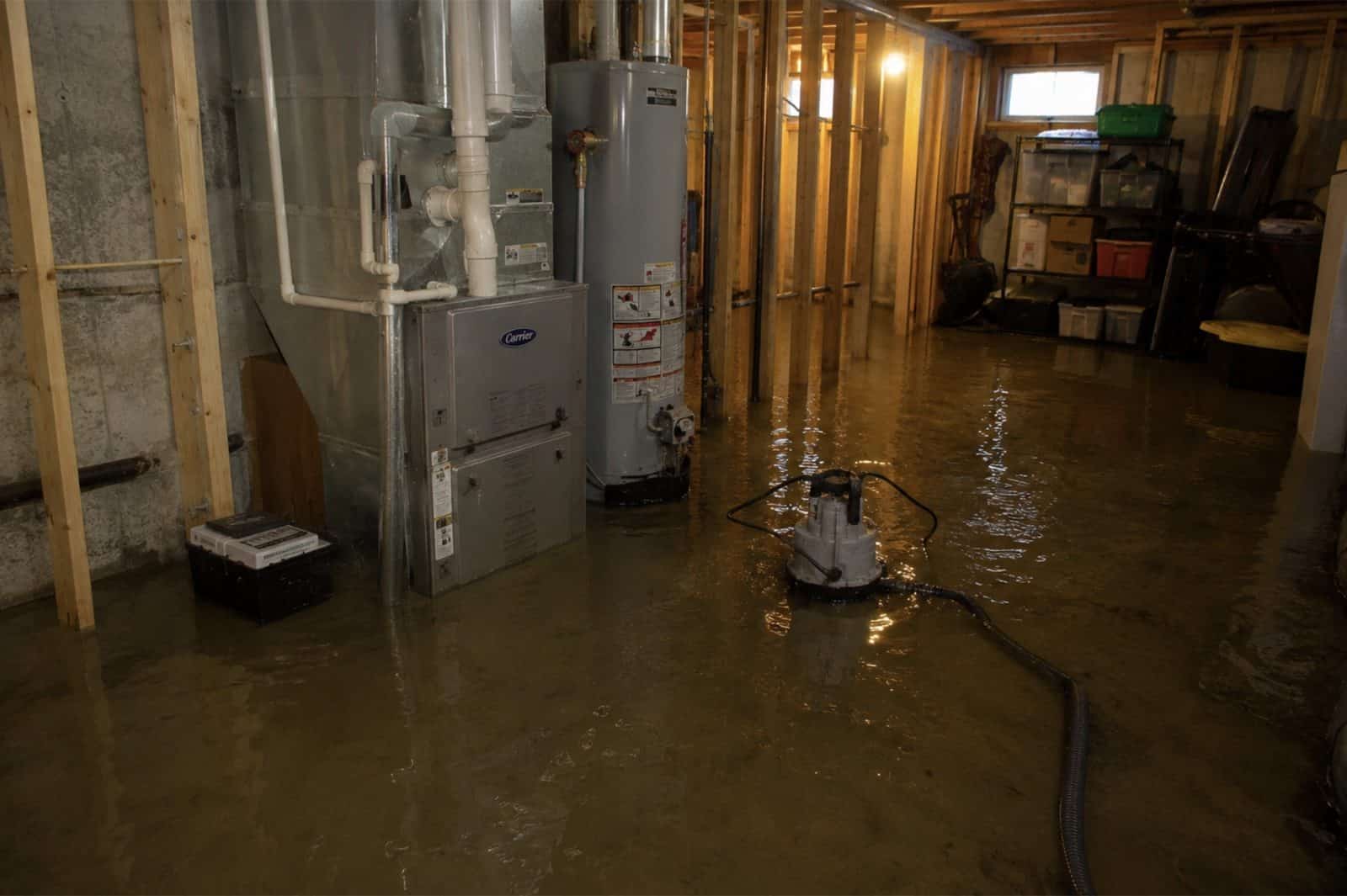
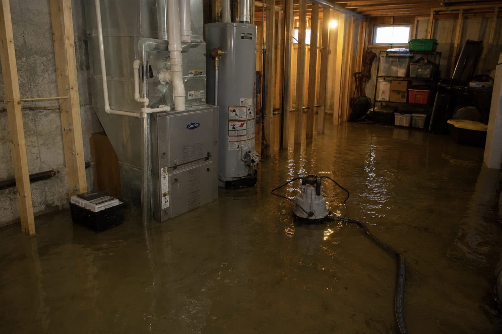
Flood and storm damage restoration in Simsbury, CT means removing floodwater, drying the structure and repairing storm damage under IICRC S500-2021 section 5.3, the standard that classifies contaminated water and sets how it is remediated. In this town that covers two emergencies handled by one crew: storm stabilisation, meaning emergency tarp-up, board-up and wind or fallen-tree impact, and Category 3 water, meaning the Farmington River leaving its banks at Weatogue and Tariffville, brook and culvert overflow on roads such as East Weatogue Street and Firetown Road, urban drainage backing up in basements that lost sump-pump power, and drain backup.
Green Restoration extracts, applies EPA-registered antimicrobial per IICRC S520-2024, dries to the ANSI and IICRC standard, and files the loss for your federal flood and Connecticut homeowners carriers. Response across Simsbury is 60 minutes, 24/7.
Simsbury Flood History
Most of Simsbury drains to the Farmington River, and the river is gauged at both ends of town: USGS 01189213 at Simsbury on 495 square miles and USGS 01189995 at Tariffville on 577. Minor flood stage at Simsbury is 12 feet and major is 18, yet the record crest is 30.1 feet, set on August 20, 1955 and unmatched since.
The town's own hazard plan states that in the Riverside Road area buildings are directly at risk of flooding and that the Town is forced to cut power before water contacts those points, leaving owners unable to run sump pumps, so those homes suffer basement damage even when the river never reaches the structure.
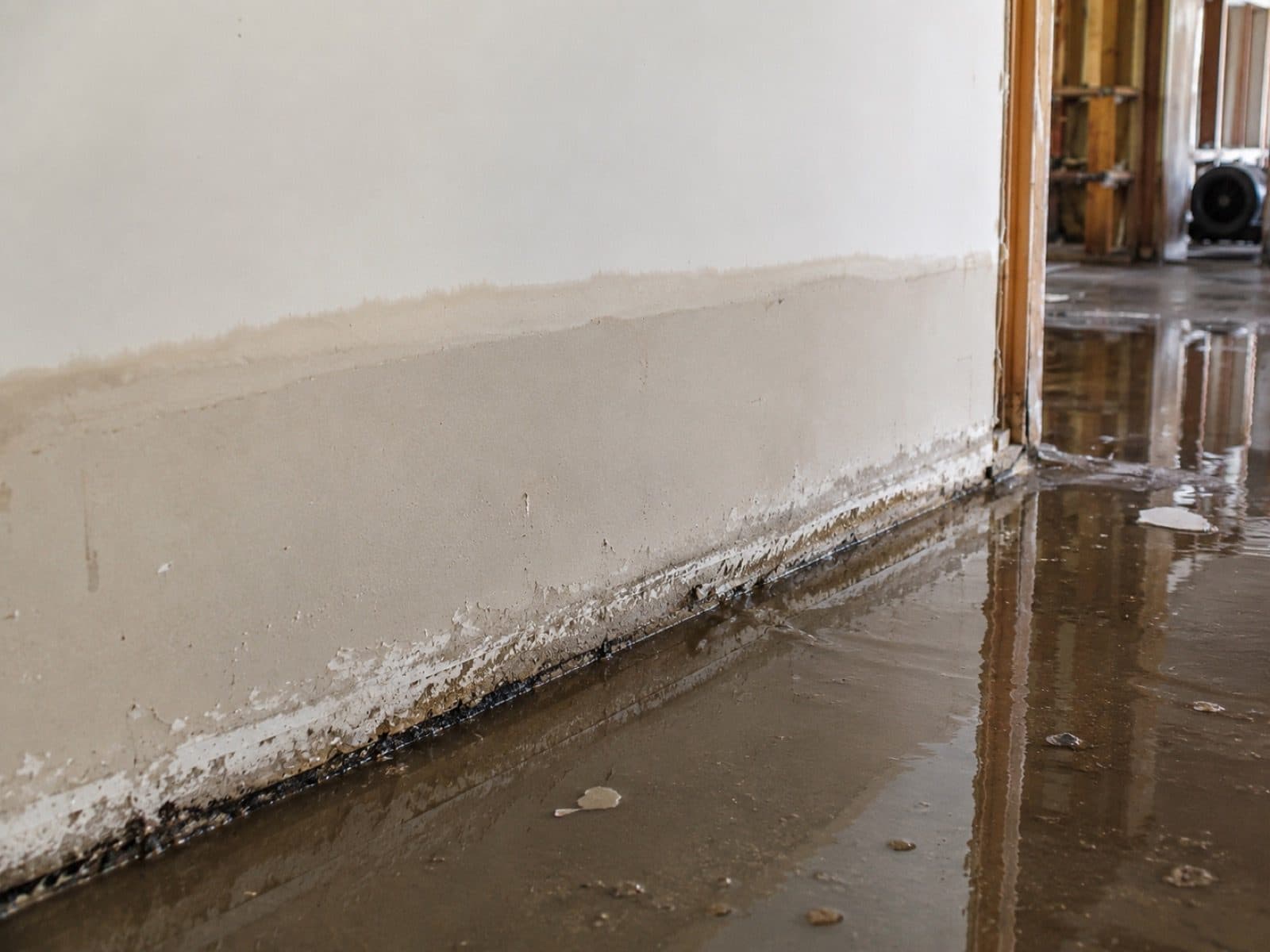
Source: 2024-2029 Capitol Region Natural Hazard Mitigation and Climate Adaptation Plan Update, Simsbury municipal annex, Section 26; USGS gages 01189213 and 01189995; NOAA National Water Prediction Service gauges SIMC3 and TARC3. Photo: FEMA / DHS, public domain (representative regional photo).
- FEMA Designation
- Special Flood Hazard Area mapped on the Farmington corridor; zone letters not published by the town, pull the parcel at the FEMA Map Service Center
- Primary Flood Vectors
- Farmington River overbank flooding at Weatogue and Tariffville, brook and culvert overflow on Lucy, Hop and Bissell Brooks, undersized stormwater drainage, sump-pump loss when the Town cuts power near Riverside Road, wind and fallen-tree damage
- NFIP Coverage Caps
- $250K building · $100K contents
- Response
- 60 min, 24/7
Verify Your Flood Zone
(860) 222-9498Complete Flood & Storm Damage Restoration In Simsbury, CT
One crew for both emergencies: storm stabilisation, tarp-up and fallen-tree work, plus flood extraction for the Farmington River at Weatogue and Tariffville, Lucy and Bissell Brook overflow, undersized drainage and basements that lost sump-pump power. Every loss documented for your insurer.
The Riverside Road Power Cut And Your Sump Pump
This is the Simsbury flood nobody outside town understands. The regional hazard plan records that in the Riverside Road area buildings are directly at risk of flooding, and that during floods the Town is forced to cut power before water contacts those points, which leaves property owners unable to operate sump pumps to remove rain, stormwater or groundwater entering their basements. The plan states that these homes then experience basement damage even when floodwaters never rise high enough to reach the structures directly. A Simsbury basement can therefore fill because the electricity went off, not because the river came in, and the scope has to say which one happened.
Cause named before the scope is written
Farmington River Stage Response At The Simsbury Gauge
The National Weather Service forecast point at Simsbury, fed by USGS station 01189213 on a drainage of 495 square miles, sets action stage at 10 feet, minor flooding at 12, moderate at 15 and major at 18. Recent history sits right inside that band: the remnants of Hurricane Ida crested at 14.38 feet on September 3, 2021, the river reached 13.92 feet on December 20, 2023 and 13.67 feet on January 11, 2024. Because the stage is published and forecast ahead, riverside work in Weatogue and along Riverside Road is staged before a crest rather than after it.
Staged on the forecast crest
Tariffville, Route 315 And A Village That Gets Cut Off
Tariffville sits in the northeastern corner of town on the inside of a sharp bend in the Farmington River, and it is the part of Simsbury that can be isolated. During Hurricane Irene and Superstorm Sandy the closure of Route 315 severed the village from the Town emergency shelter, and a separate flash flood overwhelmed drainage in the state right-of-way on Route 189 and closed the intersection of Route 189 and Elm Street, limiting access to Tariffville from Bloomfield. Crews plan the Tariffville approach around which of those two routes is passable, because the shortest line into the village is often the closed one.
Approach planned around the closed road
Additional Restoration Services
Lucy Brook, Bissell Brook And Undersized Drainage
The Farmington is only part of the picture. The town lists Bissell, Grimes, Hop, King Philip, Nod, Minister, Munnisunk, Owens, Saxton, Second and Still Brooks alongside the river, with Stratton Brook and Lucy Brook named elsewhere in the same plan. During the summer storms of 2021 the town reported small drainage systems overwhelmed, culverts exceeded, erosion along the Farmington riverbank, Lucy Brook overtopping East Weatogue Street, a culvert of concern on Quarry Road and Firetown Road overtopped by the church. The town states plainly that it is concerned about undersized stormwater infrastructure, and a brook loss behaves nothing like a river loss.
IICRC S500 Category 3 Black Water Extraction
Farmington River water, brook overflow and anything that has crossed a Simsbury road arrives as Category 3 under S500-2021 section 5.3, because it carries roadway runoff, soil bacteria and storm-sewer content whatever it looks like against a basement wall. Crews work in Tyvek and N95 with truck-mounted Hydramaster extraction and solids-rated submersible pumps, remove porous material to the sill plate, apply EPA-registered antimicrobial per S520-2024, and dry to logged readings rather than to a fixed number of days.
Access Planning Around The Roads That Close First
Simsbury has written down which roads fail and in what order. During Irene and Sandy, Route 185 closed at East Weatogue Street and severed a major east and west artery, Town Forest Road flooding blocked access to the Public Works Campus, and Riverside Road flooding blocked emergency vehicle access from the Town Center. Raising Route 185 and Riverside Road above the 1-percent flood level remains an identified mitigation need rather than finished work. Dispatch treats that list as a routing document, so a crew heading for Weatogue or Terry's Plain leaves with a second way in already chosen.
A Two-Foot Freeboard Town, And The Gap Inside It
Simsbury zoning requires new construction and substantial improvement to be built with two feet of freeboard above the FEMA 1-percent-annual-chance flood elevation, which the regional plan calls a higher standard than that required by FEMA. Those floodplain regulations were adopted in a Zoning Regulations update effective April 30, 2018. The same plan also records that the rules may be strengthened by revising the definition of substantial damage and substantial improvement, because that threshold is currently rarely triggered. Most repairs therefore never reach the stricter standard, and an owner can rebuild straight back to the elevation that flooded.
The Riverbank Above Riverside Road Is Still Moving
This is an open condition rather than history. The regional plan records that a large length of the riverbank adjacent to Riverside Road has moved since 2019 and that the town surveys the area quarterly. Gabion baskets installed along the western shoulder after earlier bank failures have since shown slump and erosion. For a property owner on that stretch it means the ground between the house and the Farmington is not fixed, which changes how a source finding is written and what a carrier is told about repeat exposure.
Emergency Roof Tarp-Up And Board-Up
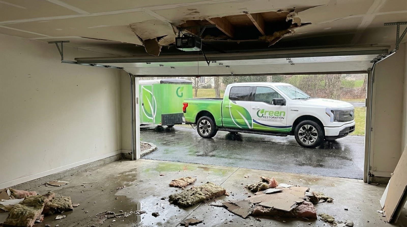
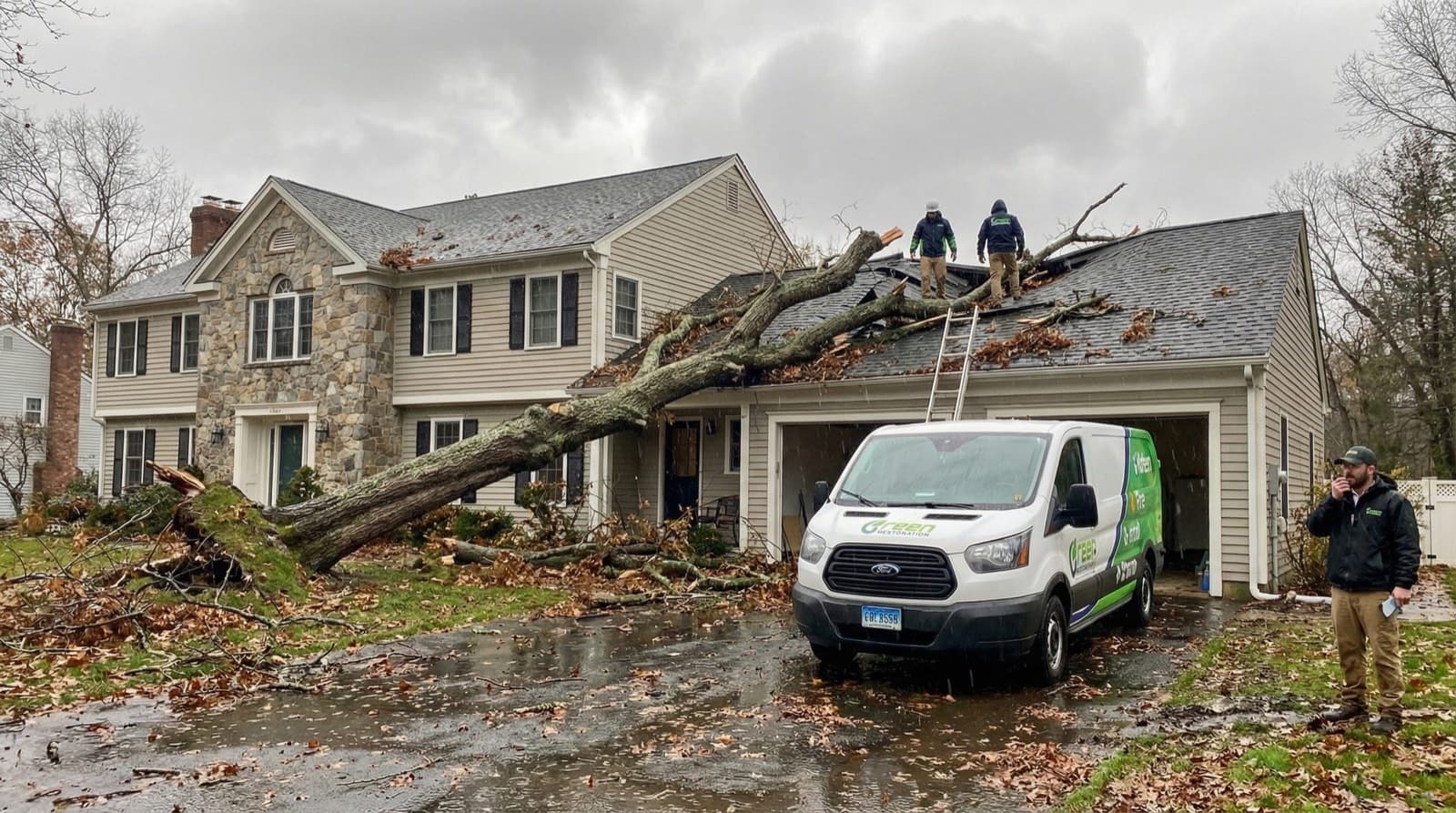
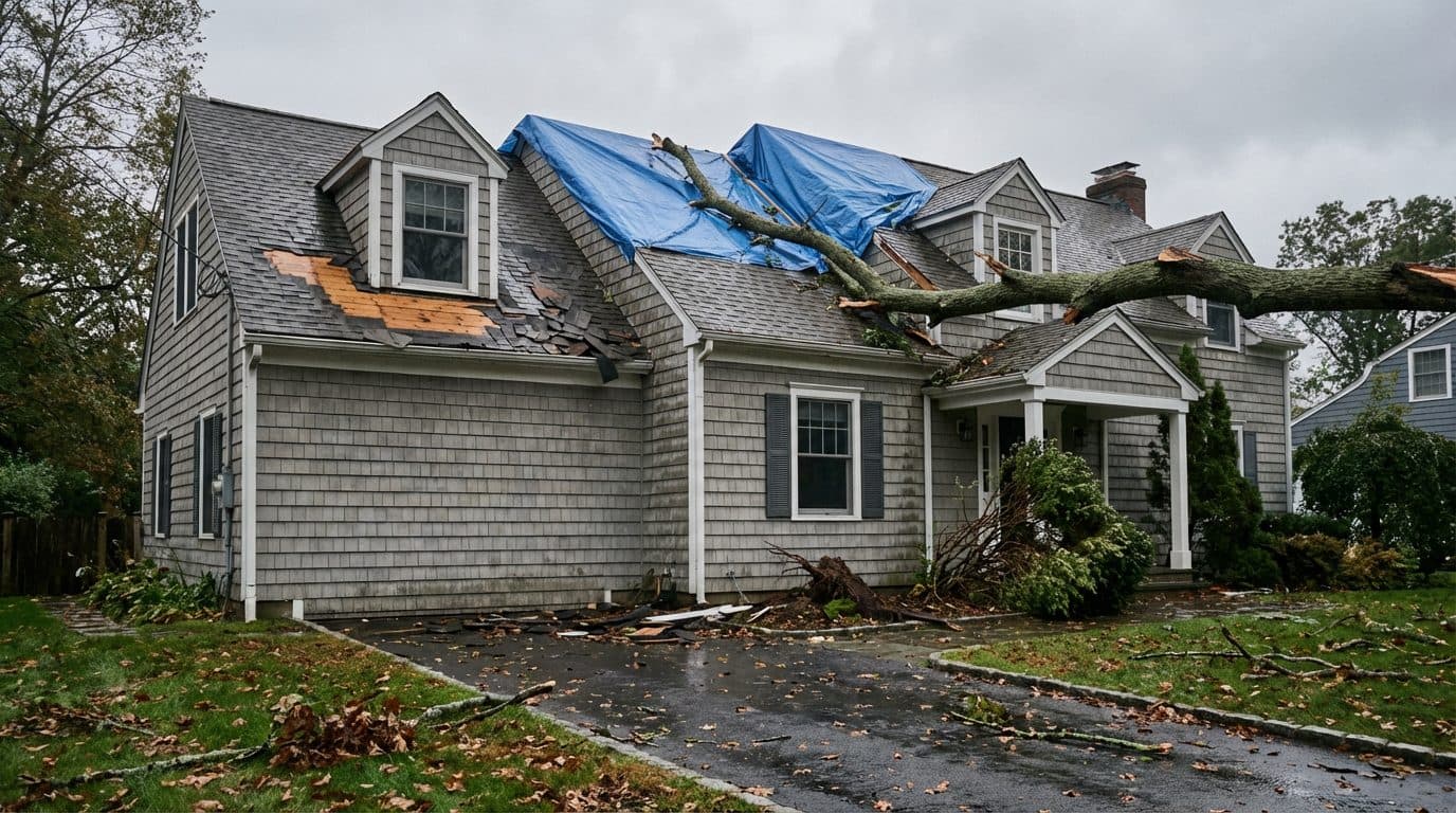
Storm stabilisation happens on the same visit as the water work. Broken openings boarded, wind-stripped or tree-struck roof sections tarped to a weather-tight seal with furring strips and roofing nails, and standing water pulled before it migrates into another assembly. Closing the envelope is what keeps a single-room loss in a Simsbury Center or West Simsbury house from becoming a whole-floor one overnight.
Wind, Fallen Tree And Canopy Impact
Simsbury carries significant tree canopy with about one third of the town in open space, and the town relies partly on Eversource for tree maintenance while coordinating with the utility on dangerous trees. That canopy is why a wind night here produces roof and envelope work as often as water work. The town also records that electrical transmission reaches the town center from two different directions, a redundancy that lowers the risk of a complete power loss. Crews arrive with structural shoring and generator power and move straight into mitigation wherever a limb or a line breached the envelope.
Federal Flood Filing And The 60-Day Window
Rising surface water is excluded from a standard Connecticut homeowner policy and needs separate federal flood cover written through a Write-Your-Own carrier, and a signed Proof of Loss is due to that carrier within 60 days of the date of loss. We hand over the S500 scope, daily moisture logs, timestamped high-water photography and a written source finding formatted for direct submission. Simsbury has not joined the FEMA Community Rating System, so no local premium discount applies while that cost and benefit review remains an open action. We are not licensed public adjusters and do not negotiate claims on your behalf.
Structural Drying And Mold Prevention
Phoenix Axial movers and LGR dehumidifiers are positioned by psychrometric calculation and run until Tramex CME 5 readings satisfy the IICRC S500 dry standard at every mapped point, with grain depression and dew point recorded daily. Older stock around Simsbury Center and Tariffville releases water slowly through plaster and masonry, so those assemblies carry monitoring points of their own instead of being averaged into a room reading. The daily logs go to your carrier as they are generated.
Do Not Let Flood Damage Set Into The Structure. Every Minute Counts.
Farmington River Staging, Riverside Road Response And Category 3 Black Water Specialists For 06070.
Why The Water Category Decides Everything In A Simsbury Flood
Per IICRC S500-2021 §5.3, every flood loss is classified Category 1, 2, or 3 before scope is signed. Category drives demolition extent, antimicrobial protocol, drying timeline, and what your insurance carrier expects to see in the documentation. Most Simsbury flooding is Category 3 from the first minute, whether it came over the Farmington bank near Riverside Road, off Lucy Brook where it overtops East Weatogue Street, or up through a basement drain in a house that lost its sump pump when the Town cut power.
Common Sources
Burst supply line, ice maker overflow, sink overflow
Restoration Protocol
Extract, dry, sanitize. Most porous materials salvageable if dried within 24 to 48 hours.
Drying typically 3 to 5 days
Common Sources
Washing machine discharge, dishwasher overflow, toilet overflow without solids, aquarium leak
Restoration Protocol
Extract, antimicrobial pre-treatment, dry, post-clean sanitize. Saturated carpet pad and porous insulation typically discarded.
Drying typically 4 to 7 days
Common Sources
Drain and sewer backup, standing surface water, Farmington River overbank water, Lucy and Bissell Brook overflow, street runoff into basements, groundwater rising after a sump-pump power loss, toilet overflow with solids
Restoration Protocol
Full PPE response, controlled demolition of porous materials to sill plate, EPA-registered antimicrobial per IICRC S520-2024, post-treatment clearance sampling.
Restoration typically 7 to 14 days including reconstruction
Why this matters for Simsbury, CT
Wind-driven rain that enters through a roof breach can stay Category 1 if treated within hours.
The same water becomes Category 2 after 48 hours in a warm cavity, and Category 3 once it contacts standing sewage, soil, or decomposing organic material.
Water that has been in the Farmington River or one of the eleven brooks the town lists, or that has run across a Simsbury road, arrives already carrying roadway runoff, soil bacteria and storm-sewer content, which puts it in Category 3 under S500 section 5.3 no matter how clear it looks. Groundwater that pushes into a lower level after a sump pump loses power is the case people misjudge most often, because it looks clean and it is not: it has passed through saturated soil beside a river the town surveys quarterly for bank movement.
According to Green Restoration, the misread that costs a Simsbury owner most is treating that post-power-cut water as clean, since the category chosen on the first morning is what decides whether porous material leaves the building or gets dried in place. Correcting it a month later is a demolition scope rather than a drying bill.
Our Flood & Storm Damage Restoration Process In Simsbury, CT
From the first call to final walkthrough, every step is documented, insured, and owner-supervised.
How would you like
to start?
Common range from Category 1 clean rainwater intrusion through Category 3 river, brook and drain-backup water with porous demolition to the sill plate. A parcel inside the Special Flood Hazard Area can also carry the town's two-foot freeboard requirement on rebuild, which sits outside the mitigation number. Final pricing follows the on-site Tramex inspection.
Get A Price Range In 60 Seconds.
Four quick IICRC S500-aligned questions. Starting figures published on this page. No call required, no email collected before you see the range.
Walk The Loss With The Owner.
Tramex CME 5 mapping and a FLIR scan of the lower level and the framing above it, plus a FEMA Map Service Center check on the parcel, since Simsbury does not publish zone letters in its own hazard plan. Free, no obligation, owner-led on every Simsbury flood job.
Ranges shown are starting figures only. Final pricing depends on on-site inspection, NFIP zone reference, and carrier coverage. We are not licensed public adjusters.
Why Choose Us In Simsbury
Owner-led service with 60-minute response, direct insurance billing, and eco-friendly methods across Simsbury.
60-Minute Emergency Response
IICRC-certified crews arrive within 60 minutes, day or night, every day of the year.
Owner-Operated Local Crew
Every job is personally overseen by our owner, from first call to final moisture reading.
Direct Insurance Billing
We bill State Farm, Liberty Mutual, USAA, Travelers, Allstate, and Chubb directly under HIC.0668405.
EPA-Registered Antimicrobials
EPA-registered antimicrobials and Safer Choice cleaning products applied per IICRC S500 and S520 standards.
Simsbury Emergency Utility Lines
Stopping water at the source is step 1 of any water-damage scope. Use these verified Simsbury lines while our IICRC crew is en route.For life-threatening emergencies (active fire, gas odor, electrical shock), call 911 first.
Water Authority
Aquarion Water Co
(800) 732-9678
24/7 emergency. Request curb-stop shutoff if your main valve fails.
Source: aquarionwater.com
Gas Leak
Connecticut Natural Gas
(866) 924-5325
If you smell gas, leave immediately, call 911 first, then this line from a safe location.
Source: cngcorp.com
Electric Emergency
Eversource Electric
(800) 286-2000
Submerged outlets or wet panel: cut breaker, then call to confirm service drop is safe.
Source: eversource.com
Police (Non-Emergency)
Simsbury Police
(860) 658-3100
Sewer-backup Cat-3 claims sometimes need a police report. Call dispatch.
Source: simsbury-ct.gov
Numbers verified against public utility and municipal sources. Green Restoration is not affiliated with these agencies. We provide these as a courtesy resource alongside our IICRC water-damage response.
FEMA Flood Zones In Simsbury, CT
Your FEMA zone decides whether your mortgage lender requires NFIP coverage, what premium tier you pay, and which Base Flood Elevation determines a covered loss. We document zone designation, BFE, and high-water mark on every Simsbury flood scope so adjusters from Wright National Flood, Allstate Flood, and Write-Your-Own carriers have what they need to approve the claim.
The Special Flood Hazard Area, the ground FEMA maps with a 1 percent chance of flooding in any given year. Cover is required on federally backed mortgages inside it.
Affected In Simsbury
The Farmington River corridor through town; the town records that its Water Pollution Control Facility sits inside a Special Flood Hazard Area behind an earthen dike
Federal flood cover required
Simsbury zoning requires new construction and substantial improvement to be built two feet above the 1-percent-annual-chance flood elevation, which the regional plan calls a higher standard than that required by FEMA.
Affected In Simsbury
Any Simsbury parcel inside the mapped floodplain undergoing new construction or substantial improvement, under regulations effective April 30, 2018
Raises the rebuild elevation, not only the premium
Ground beyond the mapped 1 percent area, including the 0.2 percent band. Federal flood cover is optional here and lower-risk ground still produces claims nationally.
Affected In Simsbury
Much of the higher ground toward Talcott Mountain and West Simsbury, where the risk is drainage and canopy rather than the river
Federal flood cover optional
Simsbury does not publish flood zone letters in its own hazard annex. It discusses the Special Flood Hazard Area and the 1-percent-annual-chance flood, so the parcel designation has to come from FEMA rather than from a town document.
Affected In Simsbury
Any Simsbury address near the Farmington River, one of the town brooks, or a culvert crossing on a low road
Check before you rely on it
Zone definitions sourced from FEMA Flood Map Service Center + 44 CFR Part 64. Verify your property zone before any policy renewal.
Where Flood Zones Hit Hardest In Simsbury
The town states buildings here are directly at risk, that power is cut before water reaches those points, and that a large length of the adjacent riverbank has moved since 2019 and is surveyed quarterly
Route 315 closed during Irene and Sandy and isolated the village from the Town shelter, which is why Tariffville Elementary School was made a secondary shelter
Lucy Brook overtopped East Weatogue Street in the 2021 summer storms, and Route 185 closed at East Weatogue Street during Irene and Sandy, severing a major east and west artery
The facility sits inside a Special Flood Hazard Area behind an earthen dike, and the town records that flood waters have reached within feet of the top of the berm; Town Forest Road flooding has blocked access to the Public Works Campus
Sourced from FEMA Map Service Center FIRM panels for Simsbury, CT. Verify your property zone before policy renewal.
What To Do After Flooding In Simsbury, CT
A river rising on a published forecast, a brook overtopping a road in twenty minutes, and a sump pump that stops because the Town cut power on purpose are three different emergencies that tend to arrive on the same night in Simsbury. Here is what to do in the first hour, and what to leave alone.
What To Do Immediately
Simsbury basements along the Farmington corridor are dark and often uneven, and the electrical panel usually sits in the lowest corner of the building. Move everyone upstairs and let Eversource clear the property before anyone goes back down for anything at all.
In the Riverside Road area the Town cuts power before floodwater reaches those points, so a dead pump during a flood is normal rather than a fault. Note the time the power went out, because that timestamp separates a groundwater loss from a river loss on your claim.
What the first frames show is what the adjuster values. Capture the highest mark on every wall, the furnace and mechanicals, anything stored at floor level, and the floor drain itself if water pushed up through it, all timestamped.
Kill the main if you can reach a dry panel without standing in water. In an older Simsbury Center or Tariffville building that is often impossible, and when there is any doubt the call goes to Eversource rather than your hand into the water.
Anything out of the Farmington River, Lucy Brook, Hop Brook or Bissell Brook, off a Simsbury road or up a drain is Category 3 under IICRC S500 section 5.3 on contact. N95, gloves and eye protection, or stay out of the space altogether.
Hartford County crews reach Simsbury in 60 minutes with truck-mounted extraction, solids-rated pumps and PPE already loaded, and we plan the approach around whether Route 185 at East Weatogue Street or Route 315 into Tariffville is passable.
What NOT To Do
A submerged outlet and a live panel turn standing water into a hazard you cannot see. Nothing stored down there is worth entering before shutoff has been confirmed with Eversource.
The Simsbury gauge is public and forecast ahead, with minor flooding at 12 feet and major at 18. If the forecast stage is still climbing, a basement that has stopped filling can start again, and going back in early is how people get caught.
A shop vac moves a few gallons and spreads contamination the entire time it runs. Farmington River water and drain backup need solids-rated pumping and truck-mounted extraction, and every surface left behind still needs antimicrobial treatment.
In an older Simsbury building the boiler or furnace is the first thing under water. Restarting it drives whatever the water carried through the whole structure. It stays off until it has been inspected.
Once it leaves the building the adjuster cannot value it. We photograph and inventory contents first, then separate what can be saved for pack-out and controlled drying.
Colonization begins inside 24 to 48 hours and older Simsbury basements hide it well. Your policy already requires you to prevent further damage, so waiting on a callback enlarges the loss and weakens your position on cover.
The Flood-Control System Behind Simsbury
Simsbury has written down what it has already done about water and what it has decided not to do. A freeboard rule stricter than FEMA, a run of culverts replaced one at a time, a shelter built instead of a raised road, and a riverbank the town measures every quarter. Each of those belongs in the file before a scope is written.
Two Feet Of Freeboard, And The Threshold That Rarely Trips
Town of Simsbury Planning and Zoning
Simsbury zoning requires new construction and substantial improvement to be built with two feet of freeboard above the FEMA 1-percent-annual-chance flood elevation, which the regional hazard plan describes as a higher standard than that required by FEMA. The updated floodplain regulations came in with a Zoning Regulations update effective April 30, 2018. The same plan records the limitation honestly: the rules may be strengthened by revising the definition of substantial damage and substantial improvement, because that threshold is currently rarely triggered. The practical consequence for a flooded owner is that most repairs never reach the stricter rule, so a house can be rebuilt at the elevation that just flooded.
The Culverts Replaced, And The One That Was Not
Town of Simsbury Public Works
Since 2014 the town has upgraded culverts at Great Pond Road, at multiple structures on Westledge Road, and at Firetown Road where it crosses Bissell Brook. On Riverside Road the culvert west of the East Weatogue Street intersection was upgraded with a backflow-prevention gate, while the culvert to the east of that intersection has not been upgraded. The crossings at Town Forest Road and Stratton Brook Road over Stratton Brook are both recorded as needing upgrades. That is a specific, checkable map of where capacity has improved and where it has not, and it explains why two houses on the same road can have very different flood histories.
A Second Shelter Instead Of A Raised Road In Tariffville
Town of Simsbury Emergency Management
Raising Route 315 above the 1-percent flood level was examined and rejected on environmental and cost grounds. Because Route 315 closing leaves Tariffville isolated, the town made Tariffville Elementary School a secondary emergency shelter, described in the plan as the only shelter available to Tariffville if Route 315 is closed and the village is cut off. Simsbury High School remains the primary shelter with two generators, and Squadron Line School is a further secondary shelter. Raising Route 185 and Riverside Road above the 1-percent flood level is still listed as a mitigation need rather than completed work.
The Dike, The Moving Bank And The Buyout That Did Not Repeat
Town of Simsbury with FEMA Hazard Mitigation Assistance
The Water Pollution Control Facility sits inside a Special Flood Hazard Area and is protected by an earthen flood-control dike, and the town records that during larger storm events flood waters have reached within feet of the top elevation of the berm. Along Riverside Road, gabion baskets installed after historical bank failures on the western shoulder have since shown slump and erosion, and a large length of that bank has moved since 2019, so the town surveys it quarterly.
The town acquired a repetitive loss property on Old Bridge Road in 2014, and a floodplain property on Iron Horse Boulevard was raised three feet above flood level through the CLOMR and LOMR process. The town also states that a past FEMA acquisition grant did not cover all the costs and that grant administration was difficult and costly, so further acquisitions are unlikely. Simsbury has not joined the FEMA Community Rating System; the cost and benefit review is a carried-forward action.
Flood Damage Restoration Coverage In Simsbury, CT
Farmington River overbank flooding, brook and culvert overflow, storm drainage backup and Category 3 cleanup for Simsbury homes and commercial property. Hartford County inland flood specialists with a 60-minute response across all 16 areas we cover in town.
Green Restoration provides IICRC S500-certified flood damage restoration in Simsbury, CT, with deep coverage across neighborhoods most exposed to Farmington River overbank flooding at Weatogue and Tariffville, Lucy, Hop and Bissell Brook overflow, undersized stormwater drainage, groundwater rising after a sump-pump power loss, and wind and fallen-tree damage.
most of Simsbury drains to the Farmington River, with only a very small southeast portion draining to the Park River; the town states that buildings in the Riverside Road area are directly at risk and that it cuts power before floodwater reaches those points, leaving owners without sump pumps; Route 185 at East Weatogue Street, Route 315 into Tariffville, Town Forest Road and Riverside Road have all closed in past storms; Lucy Brook has overtopped East Weatogue Street and Firetown Road has been overtopped by the church; and the National Weather Service puts minor flood stage at the Simsbury gauge at 12 feet against a record crest of 30.1 feet.
With direct access via Routes 10, 202 and 167 running north to south, with Routes 185, 309 and 315 running east to west from our Hartford County location, our IICRC-certified crews respond in 60 minutes, day or night.
As a locally owned company based at Hartford-Tolland Mobile Dispatch, serving Simsbury and the Farmington Valley, CT, we know the specific challenges Simsbury properties face: older village stock around Simsbury Center and Tariffville where plaster and masonry hold water long after the finished face reads dry, riverside property along Riverside Road and Weatogue where the water table and the Farmington sit close to the basement floor and the sump pump is the only thing holding the line, and hillside property toward West Simsbury and Talcott Mountain where the problem is fast surface runoff into window wells and slab penetrations rather than river stage, and the IICRC S500 §5.3 Category 3 protocol every flood requires on arrival.
We submit IICRC-standard documentation directly to your insurer. We are not licensed public adjusters and do not negotiate claims on your behalf.
Flood Emergency In Simsbury?
Category 3 dispatch and NFIP documentation, 24/7/365.
(860) 222-9498IICRC Certified Firm · Licensed & Insured · CT HIC.0668405 · All Insurance Accepted
See typical Simsbury flood damage pricing in 60 seconds. Category 1 to 3.
All Towns Served By Green Restoration Of Hartford County From Our Hartford County Location For Emergency Flood Damage Restoration & NFIP Documentation.
Free On-Site Assessment
Not sure what you are dealing with in Simsbury?
We establish the scope on site, before anything is quoted.
(860) 222-9498How The Farmington Valley Shapes A Simsbury Flood Scope
Simsbury is a suburban town of about 24,517 people across 33.9 square miles, with elevation running from roughly 150 to 500 feet and Talcott Mountain forming the eastern boundary along the Metacomet Ridge. Most of the town contributes to the Farmington River watershed, although a very small portion in the southeast drains instead to the Park River. Alongside the river the town lists Bissell, Grimes, Hop, King Philip, Nod, Minister, Munnisunk, Owens, Saxton, Second and Still Brooks, with Stratton Brook and Lucy Brook named elsewhere in the same plan, and it states plainly that it is concerned about undersized stormwater infrastructure.
The river is gauged at both ends of town: USGS 01189213 at Simsbury on 495 square miles of drainage, and USGS 01189995 at Tariffville on 577, which means the 82 square miles of difference is Simsbury's own runoff arriving between the two readings. Minor flood stage at Simsbury is 12 feet and major is 18, yet the record crest is 30.1 feet on August 20, 1955, with 22.1 feet later the same year and 18.2 feet on January 2, 1949 behind it.
Modern events sit far lower: Irene reached 16.98 feet on August 29, 2011, Ida 14.38 feet on September 3, 2021, and the river crossed minor stage again at 13.92 feet on December 20, 2023 and 13.67 feet on January 11, 2024. According to Green Restoration, the detail that changes a Simsbury scope more than any crest figure is the town's own admission that in the Riverside Road area it cuts power before water contacts those points, leaving owners unable to run sump pumps, so those homes take basement damage even when floodwaters never reach the structure. A scope that treats every Simsbury basement as river intrusion will be wrong on a large share of them.
24/7 Flood & Storm Damage Response In Simsbury, CT
Our IICRC-certified Hartford County flood crew answers Simsbury Category 3 emergencies around the clock. Response into 06070 is 60 minutes with full PPE, Hydramaster extraction and solids-rated pumps already loaded, and when the Simsbury gauge is forecast to climb toward 12 feet we stage before the crest rather than waiting for it.
Calls answered around the clock by our team or AI assistant and transferred to a human on flood emergencies. Trucks leave the Hartford County base with full PPE reaching Simsbury in 60 minutes, and stage on the forecast when the Simsbury gauge is climbing rather than after the crest.
Every flood job follows IICRC S500-2021 section 5.3 and S520-2024: full PPE extraction, controlled porous demolition to the sill plate, EPA-registered antimicrobial, structural drying with daily Tramex CME 5 verification, and independent laboratory clearance before reconstruction.
Simsbury does not publish flood zone letters in its own hazard annex, so we pull the FEMA Map Service Center designation for the address at the start. The town also requires two feet of freeboard above the 1-percent-annual-chance flood elevation, which affects rebuild height and belongs in the estimate rather than surfacing at the permit counter.
The 60-day Proof of Loss deadline on a federal flood policy is enforced strictly. Every Simsbury flood project is documented with timestamped photo logs, daily moisture readings, the FEMA parcel designation and a complete scope packet ready to file well inside the window.
About Green Restoration In Simsbury, CT

Your Simsbury Flood & Storm Damage Specialists Since 2014
Green Restoration provides IICRC S500 flood damage cleanup and structural drying for homes, commercial buildings and light industrial property throughout Simsbury, CT. The protocol centers on Category 3 black water extraction, controlled porous demolition across village and post-war stock alike, EPA-registered antimicrobial per S520-2024, the FEMA Map Service Center designation pulled for the parcel before scope, and federal flood documentation opened on the first call. We work with property owners, Write-Your-Own flood carriers and Connecticut homeowners insurers to scope the loss plainly, log moisture daily, and bring every affected assembly to the ANSI and IICRC dry standard before reconstruction is discussed. We are not licensed public adjusters and do not negotiate claims on your behalf.

“As the local co-owner across Hartford County, I bring 15 years in restoration and IICRC AMRT plus WRT certifications to every Simsbury flood scope. Simsbury is the town where I have to ask a different first question. On the river side at Weatogue and Tariffville you get warning, because the stage is published and forecast, and the work is about staging before the crest. Near Riverside Road you can get a flooded basement with the river still in its banks, because the Town cuts the power on purpose before the water reaches it and the sump pump stops. Those two losses look identical at the bottom of the stairs and they belong to different carriers. Every Simsbury job gets my direct oversight, documented to S500 standard, billed to your carrier.”
How Much Does Flood Damage Restoration Cost In Simsbury, CT?
Cost follows the IICRC S500 Category, the wet square footage and the rebuilding behind it. Most Farmington River, brook and drain-backup claims in Simsbury land in the Category 3 band from $8,000 to $50,000 plus, driven by porous demolition to the sill plate and laboratory-verified clearance.
River + Drain Backup
$8,000 to $50,000+
Farmington River and brook water and basement drain backup, silt removal, porous demolition to the sill plate, laboratory-verified clearance
Surface Flooding
$3,500 to $12,000
Street runoff and storm ponding into a finished lower level with light silt loading
Clean Rainwater
$1,500 to $4,500
Rain through an opening the wind created, handled within hours of the storm
Final cost depends on the water Category, wet square footage, drying duration, porous demolition scope to the sill plate, how long the lower level sat wet after a sump-pump power loss, and any rebuild elevation set by the town two-foot freeboard rule. Use the calculator above for a personalised Simsbury estimate.
Simsbury Flood Damage Restoration FAQs
Straight answers on the Riverside Road power cut and lost sump pumps, the Farmington River stages at the Simsbury and Tariffville gauges, the 1955 record crest, FEMA parcel designations and the two-foot freeboard rule, federal flood cover and the 60-day deadline, Category 3 protocol, cost and timeline.
Because in the Riverside Road area the power is cut on purpose. Simsbury records the sequence in its own regional hazard plan: buildings there are directly at risk of flooding, and during floods the Town is forced to cut power before water contacts those points, which leaves property owners unable to operate sump pumps to remove rain, stormwater or groundwater entering their basements. The plan then states that these homes experience basement damage even when floodwaters never rise high enough to reach the structures directly.
According to Green Restoration, that makes a large share of Simsbury basement flooding an electrical event with a water consequence, so the first thing our source finding establishes is whether the Farmington River entered the building or whether the pump simply stopped while the groundwater kept coming.
There is a published answer you can watch during the storm. The National Weather Service forecast point at Simsbury, fed by USGS gage 01189213 on a drainage of 495 square miles, sets action stage at 10 feet, minor flooding at 12 feet, moderate at 15 and major at 18. Recent crests sit inside that band rather than in the distant past: the remnants of Hurricane Ida reached 14.38 feet on September 3, 2021, the river hit 13.92 feet on December 20, 2023 and 13.67 feet on January 11, 2024, all above minor flood stage.
Tropical Storm Irene remains the highest modern reading at 16.98 feet on August 29, 2011, which is still below moderate. Watching the forecast stage is what lets a Simsbury crew stage equipment before a crest instead of chasing it afterward.
August 20, 1955, when the Farmington River crested at 30.1 feet on the Simsbury gauge. Major flood stage there is 18 feet, so that crest stood twelve feet above major, and more than seventy years later nothing has come close to it. The same year produced the second highest reading as well, 22.1 feet on October 17, 1955. Third on the list is 18.2 feet on January 2, 1949 and fourth is 17.8 feet on November 5, 1927. At the Tariffville gauge downstream the August 19, 1955 crest is logged at 22.8 feet on the old datum, the highest figure in that table.
The honest conclusion for a Simsbury homeowner is that the town's flood ceiling is far above anything anyone living there has personally seen, because Irene, the worst modern event, never reached moderate stage.
The town names them, and the list is short enough to memorise. During Hurricane Irene and Superstorm Sandy, Route 185 closed at East Weatogue Street and severed a major east and west artery, Route 315 closed and isolated the Tariffville village area from the Town emergency shelter, Town Forest Road flooding blocked access to the Public Works Campus, and Riverside Road flooding blocked emergency vehicle access from the Town Center. A separate flash flood overwhelmed drainage in the state right-of-way on Route 189 and closed the intersection of Route 189 and Elm Street, limiting access to Tariffville from Bloomfield.
In the summer storms of 2021 Lucy Brook overtopped East Weatogue Street, Firetown Road was overtopped by the church, and Quarry Road was flagged as a culvert of concern. Green Restoration routes Simsbury crews by which of those is under water rather than by the shortest distance.
You have to pull it for the parcel, because Simsbury does not publish it. The town's regional hazard annex discusses the Special Flood Hazard Area and the 1-percent-annual-chance flood elevation repeatedly, including the fact that the Water Pollution Control Facility sits inside a Special Flood Hazard Area behind an earthen flood-control dike, but it never lists zone letters for the town. The designation that governs your obligations comes from the FEMA Map Service Center for your address and nowhere else.
What Simsbury does publish is stricter than FEMA: zoning requires new construction and substantial improvement to be built with two feet of freeboard above the 1-percent-annual-chance flood elevation, adopted in a Zoning Regulations update effective April 30, 2018. Pull the parcel designation before a purchase, a renewal or a rebuild.
Not for the flood itself. Surface water, river overflow and rising water are excluded as a class from Connecticut HO-3 and HO-5 forms, so the Farmington River leaving its banks at Weatogue or Tariffville, Lucy Brook overtopping East Weatogue Street and street water running into a Simsbury lower level all fall to a separate federal flood policy written through a Write-Your-Own carrier. Your homeowners policy generally does respond to a burst supply line, an appliance overflow and rain driven through an opening the wind itself created. Drain and sewer backup sits outside the base form unless you bought the backup endorsement.
Because one Simsbury storm night often causes damage under both forms at once, we build the two scopes separately and send each to the carrier that owns it. We are not licensed public adjusters and do not negotiate claims on your behalf.
Because the Farmington picks up the whole town between them. The river enters Simsbury near Weatogue and leaves through the Tariffville Gorge, and there is a gauge at each end: USGS 01189213 at Simsbury measures 495 square miles of drainage, and USGS 01189995 at Tariffville measures 577. The 82 square miles of difference is essentially Simsbury's own brooks arriving. The stages differ accordingly, with Tariffville set at action 8 feet, minor flood 9, moderate 10 and major 11, against 10, 12, 15 and 18 at Simsbury.
The Tariffville peak of record is 29,900 cubic feet per second at 14.00 feet on September 22, 1938, and its record runs from 1913 to 2025 with a long gap between 1938 and 1971. For a Simsbury property owner the practical point is that an upstream reading is not your reading, and the crew scoping the loss should be quoting the gauge that actually sits below you.
They decide how much of the basement survives. S500-2021 section 5.3 sorts water by contamination rather than by appearance. Category 1 is clean supply water from a broken pipe or an appliance connection, and most porous material can be saved if drying starts inside 24 to 48 hours. Category 2 is grey water off a washing machine, dishwasher or an overflowing fixture without solids, which needs antimicrobial pre-treatment and removal of saturated pad and insulation. Category 3 is the contaminated tier: drain backup, standing surface water, and anything out of the Farmington River or a Simsbury brook such as Lucy, Hop or Bissell.
Category 3 brings full PPE, controlled removal of porous material up to the sill plate, EPA-registered antimicrobial under S520-2024 and verification afterward. River and street water in Simsbury is Category 3 from the moment it enters, however clear it looks against the wall.
Sixty days from the date of loss, and the courts have not been forgiving about it. The signed Proof of Loss goes to your Write-Your-Own flood carrier, and being late is by itself a reason for the claim to fail, which is why Green Restoration treats the paperwork as part of the emergency rather than as something that follows it. From the first visit in Simsbury we build timestamped photographs, daily moisture readings taken to S500, photographs of the high-water line on every affected wall, the FEMA Map Service Center designation for the parcel and an itemised scope written in the format an adjuster can work from directly.
A Simsbury owner should reach that deadline holding a complete file whether the water came off the Farmington, out of a brook or up through a basement drain.
It follows the water category, the wet square footage, the length of the drying curve and how much rebuilding sits behind it. Surface water or storm ponding into a finished Simsbury lower level, handled as Category 2, generally runs between 3,500 and 12,000 dollars for extraction, antimicrobial treatment and structural drying. Category 3 work, meaning Farmington River or brook water or a drain running backward, typically starts near 8,000 dollars and runs to 50,000 and beyond, because porous material has to come out to the sill plate, the crew works the whole job in PPE, and clearance is verified by an independent laboratory.
Older stock around Simsbury Center and Tariffville extends that curve because plaster and masonry give water up slowly. If the parcel sits inside the Special Flood Hazard Area, the town's two-foot freeboard requirement can also raise the rebuild elevation, which is a separate figure from the mitigation cost.
Yes, and separating it from the flood is what protects the claim. Connecticut homeowner policies generally do cover wind, hail and tree impact to the structure, including water that enters through an opening the wind created, subject to your deductible. They do not cover rising water. Simsbury is a heavily wooded town with about one third of its land in open space, and the town coordinates with Eversource on tree maintenance and on dangerous trees, so a wind night here reliably produces canopy damage alongside whatever the rain does.
The town also budgets roughly 5,000 dollars in cleanup for a typical thunderstorm and about 40,000 dollars for a typical winter storm, which is a fair measure of how often the trees come down. One storm can therefore produce two claims under two different policies, so we document each cause on its own and send the right scope to the right carrier. We are not licensed public adjusters and do not negotiate claims on your behalf.
Yes, and the correct designation matters if you are reading permit rules. The stretch of the Farmington that runs through Simsbury lies inside the 27.2-mile Lower Farmington River segment that Congress added to the Wild and Scenic Rivers Act through Section 1301 of the John D. Dingell, Jr. Conservation, Management, and Recreation Act, signed March 12, 2019. The statute defines that segment by physical endpoints, beginning 0.2 miles below the tailrace of the Lower Collinsville Dam and extending to the site of the Spoonville Dam in Bloomfield and East Granby, and Simsbury sits entirely between them.
Its classification is recreational river, not wild and not scenic, and the Lower Farmington River and Salmon Brook partnership counts Simsbury among its nine member towns. None of that changes how a flooded basement is dried, but it does affect what may be done to a riverbank, which is worth knowing before repair work is planned near the water.

