Flood & Storm Damage Restoration Orange, MA
Millers River High Water And Storm Damage, Restored Western Mass Dispatch On Route 2, Direct Insurance Billing
 IICRC Certified
 Eco-Friendly Solutions For Healthier Spaces
Reviewed by David Megeneishvili·Fully Insured·IICRC AMRT + WRT
What Is IICRC S500 §5.3 Flood Damage Restoration?
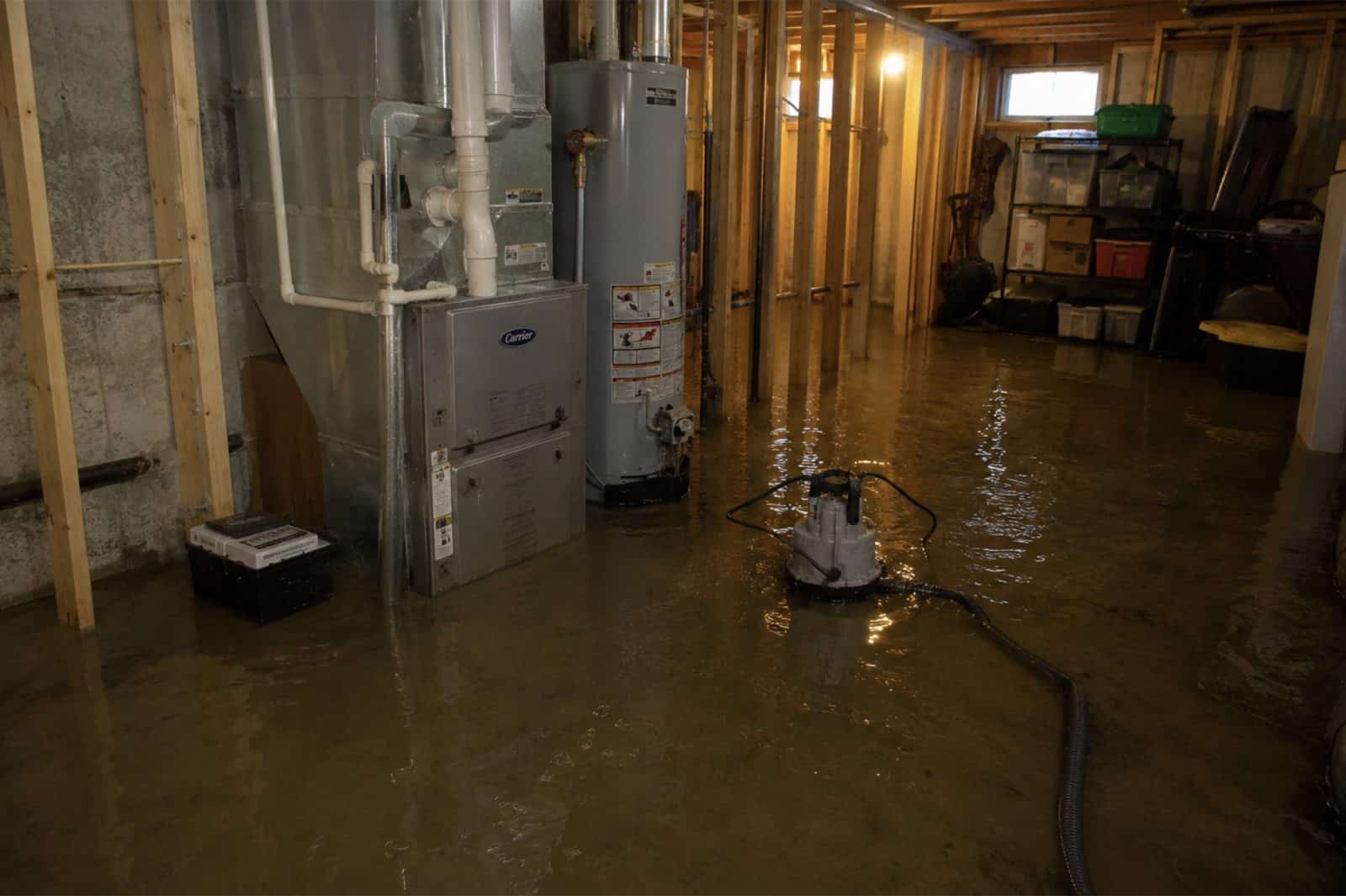
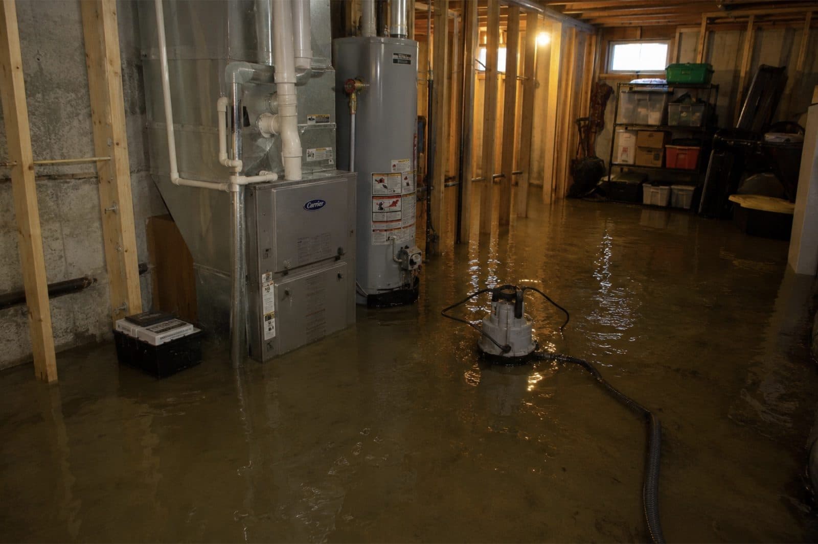
Flood damage restoration is the IICRC S500-2021 §5.3 documented process for Category 3 black water: full PPE response, controlled demolition of porous materials to sill plate, EPA-registered antimicrobial application per IICRC S520-2024, structural drying to ANSI/IICRC dry standard, and lab-verified post-remediation clearance before reconstruction. Millers River high water, street runoff and drain backup all arrive as Category 3 on contact, however clear the water looks against a cellar wall.
In Orange, MA, Green Restoration sequences every flood scope: 60-minute dispatch, FLIR thermal mapping and Tramex CME 5 moisture verification, truck-mounted Hydramaster extraction, controlled porous demolition, antimicrobial treatment, Phoenix Axial drying monitored daily, and a carrier-ready scope file with NFIP-formatted documentation, base flood elevation reference, and high-water-mark photographs filed within the 60 days NFIP Proof of Loss window.
- IICRC S500-2021 §5.3 aligned
- IICRC S520-2024 antimicrobial protocol
- ASTM E1745 Class I vapor retarder
- ASHRAE 160 humidity targets
- NFIP-formatted scope packet
- FEMA Map Service Center referenced
The Four Layers Of Flood Coverage In Orange
NFIP Building
$250,000
single-family cap
NFIP Contents
$100,000
residential cap
FEMA IA Grant
$43,600
+ $43,600 ONA
SBA Home Loan
$500,000
from 2.875%
Your standard MA homeowners policy excludes flood, surface water, tidal overflow, and wave action. NFIP closes the gap with a 30 days waiting period and a 60 days Proof of Loss deadline. Add $30,000 Increased Cost of Compliance for elevation requirements.
NFIP caps single-family coverage at $250,000 building and $100,000 contents, with separate building and contents deductibles (per FEMA NFIP and Massachusetts Division of Insurance guidance). This information is general education only, not insurance, legal, or coverage advice. We submit IICRC documentation directly to your insurer. We are not licensed public adjusters and do not negotiate, adjust, interpret your policy, or settle claims on your behalf.
How to clean up after a flood: our step by step first 48 hours guideConditions from the National Weather Service and Open-Meteo.
Trusted by Families in Orange &
Franklin County
4.9 out of 5, Rated by your neighbors on Google
We discovered mold when removing our pellet stove and called Green Restoration for help. David was very communicative and helpful throughout the entire process. He did the job thoroughly and professionally. Highly recommended!
David Woolner
Mold RemediationI had a fantastic experience with Green Restoration. From start to finish, the team was professional, thorough, and extremely knowledgeable. David came for the initial inspection and took the time to explain the entire process.
Annmarie Gieparda
Mold RemediationWe had mold due to a water leak in our half finished basement. David and his crew did a great job, we were very satisfied. I would highly recommend Green Restoration to anyone.
Tanya
Water DamageI needed my entire condo completely cleaned after a soot blow back. Green Restoration was top shelf! So thorough and professional. Thank you so much!
Jacki Hornish
Fire & Soot CleanupMore Green Restoration Services in Orange
The same local Green Restoration team covers all of these across Orange. One number for every emergency and every cleanup.
What Does Flood & Storm Damage Restoration In Orange, MA Involve?
Flood and storm damage restoration in Orange, MA means extracting floodwater, drying the structure and repairing storm damage under IICRC S500-2021 §5.3, the standard that classifies contaminated water and sets how it is remediated. Here that covers two emergencies handled by one crew: storm stabilization (emergency tarp-up, wind and fallen-tree impact, board-up) and Category 3 water (Millers River high water through the town center, street runoff into riverbank block cellars, backup on the downtown grid, hill runoff off the North Orange side, and melt crossing frozen ground).
Green Restoration extracts, applies EPA-registered antimicrobial per IICRC S520-2024, dries the assembly to the ANSI/IICRC standard, and documents the loss for your NFIP and Massachusetts homeowners carriers. Crews run the Route 2 corridor and typically reach Orange within 50 to 80 minutes, 24/7.
Orange Flood History
The Millers River flows through the center of Orange and drains the town, and the downtown Orange Center Historic District grew outward from a bridge thrown across it in 1785, which is why the 19th-century blocks stand on the banks rather than back from them. Major Millers River floods hit in 1900, 1936 and 1938.
The US Army Corps of Engineers states that Birch Hill Dam was among the first dams it built in New England to reduce damage from floods like those that devastated Athol and Orange in 1936 and 1938, and in the 1938 hurricane Millers River floodwaters at Farley Flats in neighboring Erving reached 5.5 feet above the highway.
Source: US Army Corps of Engineers, New England District; National Register of Historic Places documentation for the Orange Center Historic District. Photo: FEMA / DHS, public domain (representative regional photo).
- FEMA Designation
- Millers River corridor through the town center and the downtown blocks
- Primary Flood Vectors
- Millers River high water, street runoff into riverbank cellars, downtown grid backup, hill runoff off the North Orange side, wind and fallen-tree damage
- NFIP Coverage Caps
- $250K building · $100K contents
- Response
- 50-80 min, 24/7
Verify Your Flood Zone
(833) 970-2121Complete Flood & Storm Damage Restoration In Orange, MA
One crew for both emergencies: storm stabilization, tarp-up and fallen-tree work, plus flood extraction for Millers River high water, riverbank cellar intrusion, downtown grid backup and hill runoff. Every loss documented for your insurer.
IICRC S500 §5.3 Category 3 Black Water Extraction
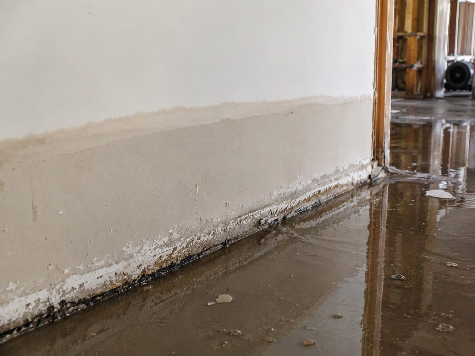
River water, street runoff and drain backup all land as Category 3 under IICRC S500-2021 §5.3. There is no waiting period on that call. Crews suit up in Tyvek and N95, run Hydramaster CDS-4.8 truck-mounted extraction alongside pumps rated for solids, take porous material back to sill plate, apply EPA-registered antimicrobial per S520-2024, and log Tramex CME 5 readings daily until the ANSI/IICRC dry standard holds at every mapped point.
IICRC S500 §5.3 · Tramex CME 5 verified
Millers River High Water In The Town Center
The Millers River runs through the middle of Orange and drains the town. That is the whole flood story in one sentence. Major events hit in 1900, 1936 and 1938, and the low ground in the center still sits where it always sat. When the river comes up we extract on arrival, photograph the intrusion path and the exterior conditions the same hour, and dry per S500 §13 rather than waiting to see how far the water drops overnight.
Documented record, documented response
Riverbank Mill Block And Storefront Cellar Response
Downtown Orange grew outward from a bridge thrown across the Millers River in 1785, so the 19th-century blocks of the Orange Center Historic District stand on the banks rather than back from them. Storefront cellars, stock rooms and mechanical spaces occupy the lowest ground in town. One event reaches several tenancies through shared cellars and shared mechanical runs. We map the whole building first, then bill each policy from its own itemized scope.
One building, one map, separate files
Additional Restoration Services
Downtown Grid Backup And Runoff Intrusion
Orange runs its own Wastewater Treatment Facility, and a long soaking rain on the downtown grid can push flow back up basement drains in buildings whose lowest floor sits near river grade. Street runoff arrives at the same doors on the same night. Backed-up sanitary water is Category 3 with a biohazard component, so containment goes up first, extraction runs on solids-rated pumps, and the file names the mechanism plainly enough for a backup endorsement to respond.
Pre-1939 Housing Stock Flood Drying
The median Orange home was built around 1938, and depending on which count you read somewhere between a third and half of the housing stock predates 1939. Old basements, original foundations and a century of layered additions mean water finds seams no modern waterproofing detail was drawn to close. Mapping decides every opening here, drying runs on controlled gradients instead of maximum heat, and the meter rather than the calendar ends the job.
Storm Stabilization, Board-Up And Fallen Tree Work
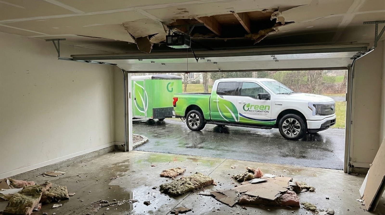
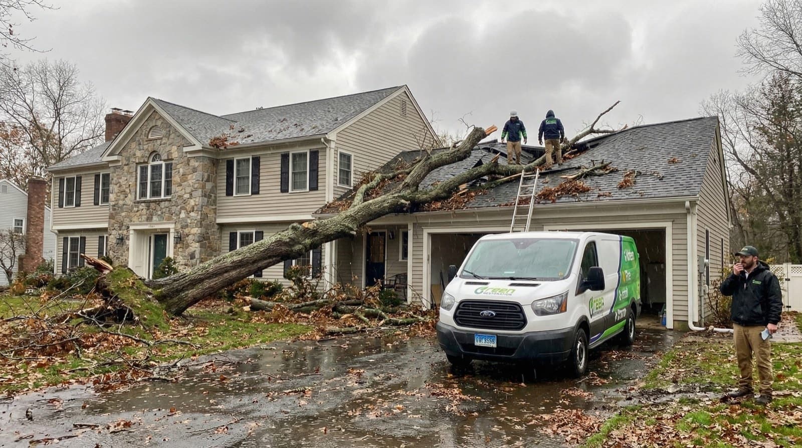
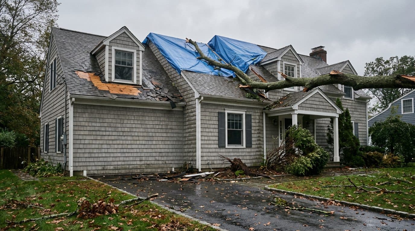
North Quabbin storms drop limbs and whole trees across the Route 2 and Route 122 corridors and drive rain through openings the wind just made. Crews arrive with tarps, board-up stock and saws and close the envelope on the first visit. Then the wind scope and the water scope stay on separate documentation tracks, because your homeowners carrier and your flood carrier read those two files independently and pay them independently.
Lake Mattawa And Lake Rohunta Shoreline Storm Damage
Orange holds the public beach on Lake Mattawa off Holtshire Road and shares part of Lake Rohunta on its southern edge. Both shorelines carry seasonal buildings that sit closed and unwatched for months at a stretch. A storm opens a roof in February and nobody sees it until April. We treat long-dwell losses as contaminated regardless of what the original water was, and we document the dwell honestly, because that is what these claims are decided on.
Tully Watershed And North Orange Hill Runoff
The East Branch of the Tully River drains hill country to the north before it passes the Corps structure at Tully Lake, and the higher ground around North Orange sheds water toward the valley on its own paths. A regional rain therefore loads this town from more than one direction at once. Runoff reaches foundations on parcels that sit nowhere near a mapped floodplain, and we trace and photograph that surface path so the cause reads clearly on the claim.
Melt Over Frozen Ground And Sump Failure
North Quabbin holds snow later than the valley towns to the west. When the thaw comes the ground underneath is still locked, so the melt runs across the surface and into basements that stayed dry all winter. The sump that handled every storm since November quits on the first warm rain. We extract, establish exactly what failed, dry to standard, and document the mechanical failure separately from any surface-water exclusion sitting in the policy.
Route 2 Corridor Commercial And Light Industrial Response
Beyond the historic core, Orange carries commercial and light industrial property along the Route 2 and Route 122 corridors and out toward the airport district, where slab construction, loading docks and floor drains change the shape of a flood loss entirely. Stock, records and equipment sit at grade. We contain and extract on a schedule that keeps the business trading where the layout allows, and we inventory affected stock separately from structure.
NFIP Documentation And The 60-Day Proof Of Loss
A flood claim runs against a federal clock. The signed Proof of Loss is due to your Write-Your-Own carrier 60 days from the date of loss, and courts enforce that deadline strictly. Every Orange flood file carries timestamped high-water photography, the daily Tramex log, FEMA Map Service Center zone reference for the specific parcel, and an itemized IICRC S500 scope written so it can go in inside the window without a rewrite first.
Post-Flood Mold Prevention And Laboratory Clearance
Wet material begins colonizing inside 24 to 48 hours, and a basement under a pre-1939 house holds enough humidity to keep that clock running long after a surface reading looks fine. Every flood scope in this town closes with EPA-registered antimicrobial per IICRC S520-2024, AMRT-supervised verification, and independent laboratory clearance sampling on Category 3 losses before reconstruction, so the flood claim closes without a mold claim opening behind it.
Do Not Let Flood Damage Set Into The Structure. Every Minute Counts.
Millers River Response, Riverbank Block Cellar Drying And Category 3 Black Water Specialists For 01364.
Why The Water Category Decides Everything In A Orange Flood
Per IICRC S500-2021 §5.3, every flood loss is classified Category 1, 2, or 3 before scope is signed. Category drives demolition extent, antimicrobial protocol, drying timeline, and what your insurance carrier expects to see in the documentation. Flooding in Orange is Category 3 from the first minute in most cases, whether it came over the bank of the Millers River in the town center, down a street into a block cellar, or back up a basement drain after a long rain on the downtown grid.
Common Sources
Burst supply line, ice maker overflow, sink overflow
Restoration Protocol
Extract, dry, sanitize. Most porous materials salvageable if dried within 24 to 48 hours.
Drying typically 3 to 5 days
Common Sources
Washing machine discharge, dishwasher overflow, toilet overflow without solids, aquarium leak
Restoration Protocol
Extract, antimicrobial pre-treatment, dry, post-clean sanitize. Saturated carpet pad and porous insulation typically discarded.
Drying typically 4 to 7 days
Common Sources
Downtown grid backup, standing surface water, Millers River high water, street runoff into riverbank cellars, toilet overflow with solids
Restoration Protocol
Full PPE response, controlled demolition of porous materials to sill plate, EPA-registered antimicrobial per IICRC S520-2024, post-treatment clearance sampling.
Restoration typically 7 to 14 days including reconstruction
Why this matters for Orange, MA
Wind-driven rain that enters through a roof breach can stay Category 1 if treated within hours.
The same water becomes Category 2 after 48 hours in a warm cavity, and Category 3 once it contacts standing sewage, soil, or decomposing organic material.
Water that has been in the Millers River or across a street arrives already carrying roadway runoff, soil bacteria and storm-sewer content, which puts it at Category 3 under S500 §5.3 regardless of how clear it looks against the wall. Calling that classification wrong on day one is exactly what turns a week of drying into a demolition scope a month later.
Our Flood & Storm Damage Restoration Process In Orange, MA
From the first call to final walkthrough, every step is documented, insured, and owner-supervised.
How would you like
to start?
Common range across Category 1 clean rainwater intrusion through Category 3 Millers River water and downtown grid backup with porous demolition scope. Final pricing follows the on-site Tramex inspection.
Get A Price Range In 60 Seconds.
Four quick IICRC S500-aligned questions. Starting figures published on this page. No call required, no email collected before you see the range.
Walk The Loss With The Owner.
Tramex CME 5 mapping plus a FLIR scan of the cellar and the framing above it. Free, no obligation, owner-led on every Orange flood job.
Ranges shown are starting figures only. Final pricing depends on on-site inspection, NFIP zone reference, and carrier coverage. We are not licensed public adjusters.
Why Choose Us In Orange
Owner-led service with 60-minute response, direct insurance billing, and eco-friendly methods across Orange.
60-Minute Emergency Response
IICRC-certified crews arrive within 60 minutes, day or night, every day of the year.
Owner-Operated Local Crew
Every job is personally overseen by our owner, IICRC AMRT and WRT certified, from first call to final moisture reading.
Direct Insurance Billing
We bill State Farm, Liberty Mutual, MAPFRE, USAA, Travelers, Allstate, and Chubb directly with full IICRC S500 documentation.
EPA-Registered Antimicrobials
EPA-registered antimicrobials and Safer Choice cleaning products applied per IICRC S500 and S520 standards.
Orange Emergency Utility Lines
Stopping water at the source is step 1 of any water-damage scope. Use these verified Orange lines while our IICRC crew is en route.For life-threatening emergencies (active fire, gas odor, electrical shock), call 911 first.
Water Authority
Orange Water Department
(978) 544-1115
Board of Water Commissioners, 16 West Myrtle Street. System operating since 1892.
Source: townoforange.org
Gas Leak
No Gas Mains, Orange Fire Rescue EMS
(978) 544-3145
No natural gas mains in Orange; homes heat with oil, propane, wood, and electric. For a propane or fuel-oil emergency leave the building and call 911, then the fire department business line.
Source: townoforange.org
Electric Emergency
National Grid MA
(800) 465-1212
Submerged outlets or wet panel: cut breaker, then call to confirm service drop is safe.
Source: nationalgridus.com
Police (Non-Emergency)
Orange Police
(978) 544-2129
Department business line. Call 911 for emergencies.
Source: townoforange.org
Numbers verified against public utility and municipal sources. Green Restoration is not affiliated with these agencies. We provide these as a courtesy resource alongside our IICRC water-damage response.
FEMA Flood Zones In Orange, MA
Your FEMA zone decides whether your mortgage lender requires NFIP coverage, what premium tier you pay, and which Base Flood Elevation determines a covered loss. We document zone designation, BFE, and high-water mark on every Orange flood scope so adjusters from Wright National Flood, Allstate Flood, and Write-Your-Own carriers have what they need to approve the claim.
1% annual chance floodplain carrying a published base flood elevation. NFIP coverage is required on federally backed loans.
Affected In Orange
Mapped Millers River parcels through the town center and the downtown blocks
NFIP required
1% annual chance floodplain with no published base flood elevation, the usual case on smaller tributaries.
Affected In Orange
Unnumbered floodplain along brooks and tributary reaches feeding the Millers
NFIP required
Sheet-flow flooding of 1 to 3 feet, typical where runoff comes off higher ground on a defined path.
Affected In Orange
Runoff paths coming down off the North Orange and Tully hill ground
NFIP depth-rated
500-year floodplain or land outside the mapped 1% chance area. Roughly 25% of NFIP claims still originate in lower-risk zones.
Affected In Orange
The higher residential streets above the center and the Route 2 corridor uplands
NFIP optional
Zone definitions sourced from FEMA Flood Map Service Center + 44 CFR Part 64. Verify your property zone before any policy renewal.
What To Do After Flooding In Orange, MA
River water over the bank, runoff down a downtown street, and a drain running backward under a block are three separate emergencies that arrive on the same bad night. Here is what the first hour looks like, and what to leave alone.
What To Do Immediately
Downtown cellars are dark, uneven and wired in layers nobody documented, and the panel usually sits in the lowest corner. Move everyone up and let National Grid clear the building before anyone goes back for anything.
The adjuster values what the first frames show. Capture the highest mark on every wall, the mechanicals, and anything stored at floor level, timestamped, plus a frame of the drain if water came up through it.
Kill the main if you can reach a dry panel without standing in water. In a pre-1939 building that is often not possible, and when there is any doubt the call goes to National Grid instead of into the water.
Anything out of the Millers River, off a street, or up a drain is Category 3 under IICRC S500 §5.3 on contact. N95, gloves and eye protection, or stay out of the space entirely.
The NFIP Proof of Loss is due to your flood carrier 60 days from that date and federal courts do not extend it. We begin building the packet on day one so the deadline never becomes the reason a claim fails.
Western Mass crews run the Route 2 corridor and reach Orange in 50 to 80 minutes with truck-mounted extraction, solids-rated pumps and PPE already loaded.
What NOT To Do
A submerged outlet and a live panel make standing water an electrical hazard you cannot see through. Nothing stored in that cellar justifies entering before shutoff is confirmed.
A shop vac moves a few gallons and spreads contamination the whole time. River water and drain backup need solids-rated pumping and truck-mounted extraction, and every remaining surface still needs antimicrobial treatment.
In a pre-1939 house the boiler or furnace is the first thing underwater. Firing it back up drives whatever the water carried through the entire building. It stays off until it has been inspected.
Once it leaves the building the adjuster cannot value it. We inventory and photograph business stock and household contents first, then separate what can be saved for pack-out and controlled drying.
Backed-up sanitary flow is a biohazard rather than a mess. Consumer cleaners do not address it and the exposure is respiratory as well as contact. Containment and EPA-registered antimicrobial come first, applied by crews in Tyvek.
Colonization starts inside 24 to 48 hours and older cellars hide it well. Your policy already obliges you to prevent further damage, so waiting on a callback grows the loss and weakens your position on coverage.
The Flood-Control System Behind Orange
Orange is a managed valley rather than a safe one. A river runs through the middle of the business district, two federal flood-control dams sit upstream because of what that river did in the 1930s, and a second watershed comes down from the north into the same lower ground. Each of those facts belongs in the file.
Millers River Through The Town Center
FEMA Region 1 + Massachusetts Department of Environmental Protection
The Millers River flows through the middle of Orange and drains the town, and the downtown historic district grew outward from the 1785 bridge across it, which is why the 19th-century blocks stand on the banks. The mapped floodplain on that reach is what drives NFIP requirements on federally backed mortgages and the first federal reference we pull on a downtown claim.
Birch Hill Dam
US Army Corps of Engineers, New England District
The Corps states that Birch Hill Dam was among the first dams it built in New England to reduce damage from floods like those that devastated Athol and Orange in 1936 and 1938. Completed in 1942 in Royalston and Winchendon, it holds 16.2 billion gallons of storage and is credited with preventing more than 80 million dollars in damages. It lowers peak flow on this stretch. It does not make the low ground in the town center high ground.
Tully Lake Dam
US Army Corps of Engineers, New England District
Completed in 1949 on the East Branch Tully River in Royalston, Tully Lake Dam stands 62 feet high and holds 7.1 billion gallons. It manages the second watershed that reaches this valley, the one coming down from the north, which matters because a heavy regional rain loads Orange from more than one direction at once and drainage that copes with an ordinary storm can be overtopped by a sustained one.
The 1936 And 1938 Flood Record
US Army Corps of Engineers, New England District
Major Millers River floods hit in 1900, 1936 and 1938, and the federal answer to the last two is still standing upstream. In the 1938 hurricane, Millers River floodwaters at Farley Flats in neighboring Erving reached 5.5 feet above the highway. We cite the record rather than dramatize it, because an adjuster reading a flood file wants the mechanism and the source, not a story.
Flood Damage Restoration Coverage In Orange, MA
Storm surge, sewer backup, and Category 3 black water cleanup for Orange homes and businesses. Franklin County coastal specialists with 60-minute response from our Western Mass location across all 12 neighborhoods.
Green Restoration provides IICRC S500-certified flood damage restoration in Orange, MA, with deep coverage across neighborhoods most exposed to Millers River high water through the town center, street runoff into riverbank block cellars, downtown grid backup, and hill runoff off the North Orange side.
The downtown blocks on West and East River Street sit on the lowest ground in town, directly on the banks the 1785 bridge was thrown across; the residential streets above them carry pre-1939 stock with original foundations; the Lake Mattawa and Lake Rohunta shorelines hold seasonal buildings that sit closed for months.
With direct access via Route 2 across the town, Route 122, and Interstate 91 by way of the Route 2 corridor from our Western Mass location, our IICRC-certified crews respond in 60 minutes, day or night.
As a locally owned company based at Serving Orange and the North Quabbin region of Franklin County, MA, we know the specific challenges Orange properties face: chloride salt corrosion in electrical and HVAC systems after storm surge, slow-drying plaster-on-lath wall cavities in pre-1960 estates, NFIP base flood elevation documentation required for Wright National Flood and Allstate Flood policies, and the IICRC S500 §5.3 Category 3 protocol every flood requires on arrival.
We submit IICRC-standard documentation directly to your insurer. We are not licensed public adjusters and do not negotiate claims on your behalf.
Flood Emergency In Orange?
Category 3 dispatch and NFIP documentation, 24/7/365.
(833) 970-2121IICRC Certified Firm · Fully Insured · All Insurance Accepted
See typical Orange flood damage pricing in 60 seconds. Category 1 to 3.
All Towns Served By Green Restoration Of Franklin County From Our Western Mass Location For Emergency Flood Damage Restoration & NFIP Documentation.
Free On-Site Assessment
Not sure what you are dealing with in Orange?
We establish the scope on site, before anything is quoted.
(833) 970-2121How The Millers River Shapes An Orange Flood Scope
Orange is a river town in the plainest sense: the Millers River runs through the center and drains the town, and downtown grew outward from a bridge thrown across it in 1785. That is why the 19th-century blocks of the Orange Center Historic District, listed on the National Register in 1989, stand on the banks rather than back from them, and why storefront cellars and mechanical rooms occupy the lowest ground in the community. The flood record is documented and it is serious.
Major Millers River floods hit in 1900, 1936 and 1938, and the US Army Corps of Engineers states that Birch Hill Dam was among the first dams it built in New England to reduce damage from floods like those that devastated Athol and Orange in 1936 and 1938. Birch Hill followed in 1942 with 16.2 billion gallons of storage and credit for more than 80 million dollars in damages prevented, and Tully Lake Dam followed in 1949, 62 feet high and holding 7.1 billion gallons on the East Branch Tully River. Storage lowers peak flow without making the town center high ground.
Between river events the losses come out of the buildings themselves. The median Orange home dates to roughly 1938 and somewhere between a third and half of the stock predates 1939 depending on the count, which puts old basements and original foundations under most addresses in town. Lake Mattawa off Holtshire Road and part of Lake Rohunta bring a shoreline of seasonal buildings that sit closed for months at a time.
The Orange Water Department has operated since 1892, funded solely by ratepayers, the town runs its own Wastewater Treatment Facility, National Grid supplies the electricity we coordinate shutoff with, and no natural gas utility reaches town at all, so heat comes from oil, propane, wood or a meter.
24/7 Flood & Storm Damage Response In Orange, MA
Our IICRC-certified Western Mass flood crew answers Orange Category 3 emergencies around the clock on the Route 2 corridor. This is the eastern edge of our territory, so the honest window into 01364 is 50 to 80 minutes with full PPE and Hydramaster extraction on board.
Calls answered around the clock by our team or AI assistant and transferred to a human on flood emergencies. Hydramaster trucks leave the Western Mass base with full PPE and run the Route 2 corridor east, typically reaching Orange within 50 to 80 minutes.
Every flood job follows IICRC S500-2021 §5.3 and S520-2024: full PPE extraction, controlled porous demolition to sill plate, EPA-registered antimicrobial, structural drying with daily Tramex CME 5 verification, and lab-verified ACAC clearance before reconstruction.
We submit IICRC S500 documentation, base flood elevation reference, timestamped high-water photography and itemized estimates directly to NFIP Write-Your-Own carriers and Massachusetts homeowners carriers (State Farm, Travelers, Liberty Mutual, USAA, Allstate, Chubb). We are not licensed public adjusters.
Federal courts enforce the 60-day NFIP Proof of Loss deadline strictly. Every Orange flood project is documented with timestamped photo logs, daily moisture readings, FEMA Map Service Center zone reference and a complete scope packet ready to file well inside the window.
About Green Restoration In Orange, MA

Your Orange Flood & Storm Damage Specialists Since 2014
Green Restoration provides IICRC S500 §5.3 flood damage cleanup and structural drying for homes, downtown commercial blocks and shoreline property throughout Orange, MA. The protocol centers on Category 3 black water extraction, controlled porous demolition across pre-1939 residential stock and 19th-century riverbank buildings alike, EPA-registered antimicrobial per S520-2024, and NFIP-formatted documentation opened on the first call. We work with property owners, NFIP Write-Your-Own carriers and Massachusetts homeowners insurers to scope the loss plainly, log moisture daily, and bring every affected assembly to the ANSI/IICRC dry standard before reconstruction is discussed.

“As the local Franchise Owner across Western Mass, I bring 15 years in restoration and IICRC AMRT plus WRT certifications to every Orange flood scope. A shared cellar under a downtown block can take water from the river and from the street on the same night, a pre-1939 house gives up moisture on its own schedule, and a shoreline building can sit wet for a season before anyone opens the door. Those are three different files. Every Orange job gets my direct oversight, documented to S500 standard, billed to your carrier.”
How Much Does Flood Damage Restoration Cost In Orange, MA?
Cost tracks the IICRC S500 §5.3 Category, the affected square footage and the reconstruction behind it. Most Millers River and downtown backup claims in Orange land in the Category 3 band from $8,000 to $50,000 plus, driven by porous demolition to sill plate and laboratory-verified clearance.
River + Grid Backup
$8,000 to $50,000+
Millers River high water and downtown drain backup, silt removal, porous demolition to sill plate, laboratory-verified clearance
Surface Flooding
$3,500 to $12,000
Hill runoff and storm ponding into a finished lower level with light silt loading
Clean Rainwater
$1,500 to $4,500
Rain through an opening the wind created, handled within hours of the storm
Final cost depends on the water Category, affected square footage, drying duration, porous demolition scope to sill plate, how many tenancies a shared cellar reaches, and any NFIP base flood elevation requirement during reconstruction. Use the calculator above for a personalized Orange estimate.
Orange Flood Damage Restoration FAQs
Straight answers on FEMA zones, NFIP coverage, what the Corps dams upstream do and do not change, Category 3 black water, backup endorsements, cost and timeline in pre-1939 stock.
Parts of it plainly are. The Millers River runs through the middle of the business district, the oldest commercial blocks stand on its banks because downtown grew outward from a bridge built in 1785, and the town carries a documented flood record from 1900, 1936 and 1938. Two federal flood-control dams were built upstream in answer to that record, which lowers the hazard without erasing it. Higher ground toward North Orange reads better on a map, although roughly a quarter of NFIP claims nationally come from lower-risk zones.
Zones are assigned parcel by parcel, so check your own address at the FEMA Flood Map Service Center at msc.fema.gov before a purchase or a renewal.
It does not. HO-3 and HO-5 forms written in Massachusetts exclude flood, surface water and river overflow by name. Millers River high water, street runoff into a downtown cellar, and melt crossing frozen ground all fall outside that policy and need a separate NFIP flood policy through a Write-Your-Own carrier. The homeowners form is generally there for a supply line letting go, an appliance failing, or rain entering through an opening the storm created. Backup through a drain requires its own endorsement. We build one IICRC S500 scope per carrier rather than handing both of them a single blended file. We are not licensed public adjusters and do not negotiate claims on your behalf.
No. They mean the valley is managed rather than immune, and the distinction matters when a claim is being written. The US Army Corps of Engineers, New England District, states that Birch Hill Dam was among the first dams it built in New England to reduce damage from floods like those that devastated Athol and Orange in 1936 and 1938. Birch Hill was completed in 1942 in Royalston and Winchendon, holds 16.2 billion gallons of storage, and is credited with more than 80 million dollars in damages prevented. Tully Lake Dam followed in 1949 on the East Branch Tully River in Royalston, 62 feet high with 7.1 billion gallons.
Storage capacity reduces peak flow. It does not repeal a heavy regional rain, and it has nothing to say about a drain running backward under your building.
Contamination, and the Category decides how much of the building leaves. Category 1 is clean supply water, and treated inside 24 to 48 hours most materials stay. Category 2 is gray water from a washer, a dishwasher or an overflow with no solids, which brings antimicrobial pre-treatment plus removal of saturated pad and porous insulation. Category 3 is black water: drain backup, standing surface water, and anything that came out of the Millers River. Category 3 means full PPE, porous material back to sill plate, EPA-registered antimicrobial per IICRC S520-2024, and laboratory clearance before reconstruction.
River water is Category 3 on arrival because of roadway runoff, soil bacteria and storm-sewer content, no matter how clear it looks standing against a cellar wall.
The Category sets the band, then square footage, drying duration and reconstruction move it. Clean rainwater caught within hours generally lands between 1,500 and 4,500 dollars. Surface water into a finished lower level typically runs 3,500 to 12,000 dollars for extraction, antimicrobial treatment and drying. Category 3 river water or a drain backup runs 8,000 to 50,000 dollars and beyond, because porous material comes out to sill plate, crews work in full PPE, and clearance has to be laboratory-verified. A shared cellar under a downtown block adds per-tenancy documentation hours a single-family basement never needs. The written estimate follows the on-site Tramex CME 5 walk rather than a number quoted over the phone.
Day one is extraction and containment. Newer framing and drywall usually clear in 3 to 5 days. With a median build year near 1938 and a large share of the stock older than 1939, most houses here run 6 to 9 days, because layered subfloor, plaster and old cellar material give up moisture slowly. A shared downtown block cellar can run longer, and a seasonal shoreline building discovered wet in spring longer still. We log Tramex CME 5 readings daily and keep equipment running until every mapped point holds the ANSI/IICRC dry standard. Category 3 losses add laboratory clearance before reconstruction begins.
Generally yes, and knowing the boundary is what keeps the claim clean. Massachusetts HO-3 and HO-5 policies typically cover wind, hail and fallen-tree damage to the structure, roof and siding damage included, plus interior water that came through an opening the wind created, subject to your deductible. They exclude rising surface water, river overflow and drain backup, which need NFIP coverage or a backup endorsement instead. One North Quabbin storm regularly delivers both on the same night, a limb through the roof and water up the cellar drain, and a single blended file is the most common reason those claims underpay. We scope and photograph each cause separately. We are not licensed public adjusters and do not negotiate claims on your behalf.
Only with a water backup or sewer backup endorsement. The base policy excludes anything entering through a drain, a sewer line or a failed sump pump. That is worth checking here, because Orange operates its own Wastewater Treatment Facility and the downtown grid serves buildings whose lowest floor sits near river grade, so a long soaking rain can push flow back up a basement drain before the river itself becomes the issue. Endorsements commonly run somewhere between 5,000 and 25,000 dollars with buy-up tiers offered. This is general education rather than coverage advice, so confirm your own limits with your agent.
If water is still entering, get everyone up out of the cellar and stay out until National Grid and local emergency services confirm the building is safe. Photograph the highest waterline on every wall, the mechanicals, and anything stored at floor level, all timestamped, before a single item moves. If it came up through a drain, photograph the drain too. Only reach the main breaker from dry footing. Treat all of it as Category 3 and stay out without PPE. Leave fans and the heating system off, because pushing air through a wet building spreads whatever the water carried into rooms that were never affected. Then call (833) 970-2121 for IICRC-certified dispatch.
A signed Proof of Loss is due to your Write-Your-Own carrier within 60 days of the date of loss, and federal courts enforce that deadline strictly. It has to document extent of damage, repair scope and replacement cost, with photographic evidence and contractor estimates behind it. Separately, the NFIP caps single-family coverage at 250,000 dollars building and 100,000 dollars contents under the Stafford Act, limits basement coverage to mechanical systems and cleanup, and applies a 30-day waiting period on a new policy.
That basement limitation carries real weight in Orange, where the cellar in a pre-1939 house holds the heating plant, the electrical and a good share of what the household owns. We supply timestamped photo logs, IICRC S500 moisture readings, FEMA Map Service Center reference and an itemized scope formatted for direct submission.

